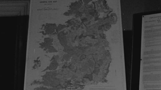
Geography lesson for school television introduces students to creating and reading maps.
Through time, humans have left more influences on the land building houses, roads, villages, towns and sprawling cities.
Since man first inhabited the earth, he has made an impression on the natural landscape.
All of these additions to the landscape present a challenge when it comes representing them on a map. Early map makers did this in an attractive but rather inaccurate way. Some of the early maps are half map, half picture. An early map of Youghal gives a general impression of the layout of the town but detailed measurements can not be made from it.
David Langride demonstrates how to map an island with rivers, roads, a forest, a village with houses, a school and a church. All the features in the village are represented using a key of the conventional symbols used in mapmaking
'Telefís Scoile' broadcast on 1 October 1968. The presenter is David Langride. The narration is in both Irish and English.