A reversal of plans to ban cars from Dublin's Bachelor's Walk is among a number of changes announced to the Dublin City Centre Transport Study following public consultation.
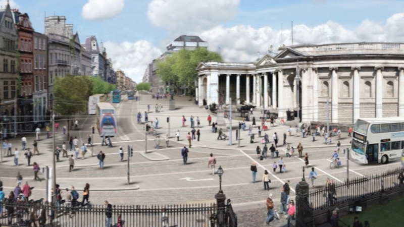
The study, which was published last year, included a new car-free plaza on College Green and other restrictions on private motorists in surrounding streets and the quays.
After considering 7,779 submissions, Dublin City Council and the National Transport Authority have announced a number of adjustments to the €150 million plan.
Cars would be allowed to turn left from Bachelor's Walk to O'Connell St to allow access to Arnott's car park, but private cars would not be allowed to turn right on to Eden Quay from O'Connell Bridge.
There would not be any bus-only sections on the south quays, although there would be more bus lanes.
Taxis would be able to travel north/souththrough College Green as previously announced as part of revised plans for the civic plaza.
The plan still provides for pedestrianising St Stephen's Green North and Suffolk St.
It also provides for making D'Olier St a bus interchange and restricting through traffic on Westmoreland St.
The city council and the NTA say the changes are necessary to cater for the cross city Luas and a predicted 20% increase in journeys into the city centre by 2023.
In reviewing the submissions the report noted that there was strong support for the civic plaza in College Green as well as improvements to pedestrian and cycling facilities.
There were concern about access to car parks and the impact on retail, access for the mobility impaired and access for taxis and deliveries.
The report states that the original study has now been revised to address some of these concerns.
Liffey cycle route to be partially diverted
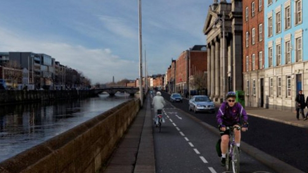
Meanwhile, the planned Liffey cycle route is to be partly diverted from the quays and run alongside the Luas red line.
Originally the plan had been to have a two-way cycle lane on the western section of the north quays and to divert buses onto the Luas line on Benburb St.
This emerged as the favoured option from public consultation on how to construct the cycleway, which would allow a continuous, segregated, two-way cycle lane from the Phoenix Park to the 3 Arena.
But the option of diverting buses was found not to be viable because planning permission had already been given to develop a parcel of land at Smithfield needed for this route.
There was also opposition from local residents and businesses.
The council reconsidered the other options but all were found to be flawed, particularly because of a pinch point at the Mellows Bridge/Queen St junction.
A boardwalk was ruled out because of the impact it would have on Mellows Bridge and the quays while having the two-way cycle route on the buildings side of the north quays was impractical because of the number of bus stops.
The proposal, which is now to be considered by a meeting of the council's transport committee next week, is to have the two-way cycle along the Luas line north of Cropies Acre, along Benburb St and by Smithfield, which was the route originally planned for bus diversion .
The cycleway would rejoin the quays at Church St.
The report states that this allows cyclists to avoid the complex junction where traffic coming from the south and west by Heuston Station joins the north quays at Frank Sherwin Bridge.
It also allows better links for students in the Grangegorman campus.