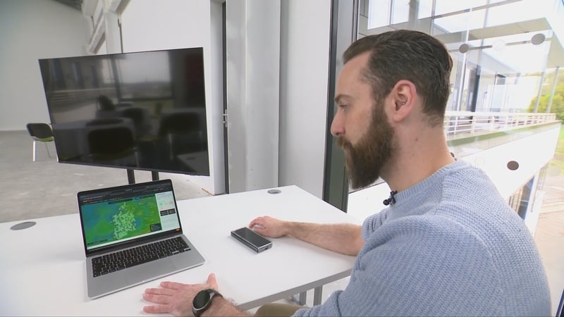

An innovation consultant, skilled in probability and data analysis, has developed a new national flood prediction system.
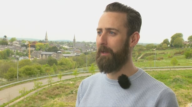
A native of Dublin, currently residing in Enniscorthy in Co Wexford, Gavyn Pedley has spent two decades analysing data and developing products and solutions in Ireland, Denmark and Spain.
His freely available Flood Predictor website and app will automatically alert people about the likelihood of flooding in their local area and is claimed to be accurate to within 10 metres at street level.
The predictor works by combining publicly available real-time weather, soil moisture, and river gauge data with artificial intelligence, machine learning, and computer programming.
Senior officials from the Office of Public Works recently told an Oireachtas Committee it would take up to ten more years to develop such a service, but this Flood Predictor website and service was completed in just two months.
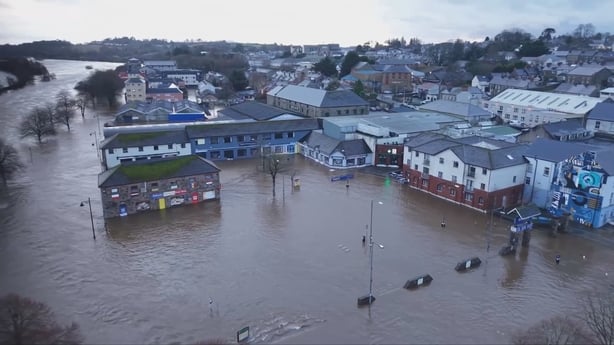
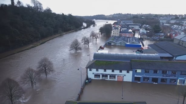
He was motivated to undertake the work after witnessing the devastating flood damage suffered in Enniscorthy because of Storm Chandra at the end of January.
"It's not the day that it floods, and it's not even looking at this massive wall of water just leaping through the town. It's not watching car parks completely flooded that gets you," Mr Pedley explains.
"It's three weeks later when you're driving down Island Road, and there are people you know still, three weeks in, pulling their belongings out and putting them in skips."
Mr Pedley said that as a parent he had a particular emotional response to the floods.
"The thing that really broke my heart was one of the people down in the town throwing out a kid's duvet, and the look on his face was just heartbreaking. I have a little girl of my own. She has a dinosaur duvet, and if I had to throw that out, it would break me."
Met Eireann's yellow rain forecast for Co Wexford during storm Chandra did serve as a warning that there could be flooding. However, nobody in Enniscorthy expected the wall of water and inundation that followed.
"The consensus was that flooding would happen. But were people expecting the kind of flooding that would float a car to Wexford? No, there wasn’t any understanding that it would get that bad", said Mr. Pedley.
Mr Pedley became aware of the vast amount of publicly available real-time data that could be used for flood prediction and warnings by reading media coverage of the flood after the storm.
This includes very detailed high-quality data about all aspects of weather from Met Eireann’s 25 globally coordinated synoptic weather stations; 20 additional very high quality automatic weather stations; 550 meteorological monitoring sites; a network of offshore buoys tracking Atlantic conditions; coastal observatories, weather radar, satellite inputs and aircraft observations; and the Citizen Science WOW network of 100 privately owned weather stations in gardens, rooftops and schools across the country.
Altogether that adds up to about 700 land-based weather monitoring stations, alongside extensive offshore and international data inputs.
In addition, the State’s agriculture and land development agency, Teagasc, publishes real-time data collected through a network of advanced soil moisture monitoring stations that measure soil saturation at multiple depths across wider areas using highly sophisticated sensors.
On top of this the Office of Public Works has a network of 380 hydrometric stations, tracking river levels and flow rates in real time right throughout the country.
Other State agencies too have hydrometric stations and publish data including the EPA, Local Authorities, ESB, the Marine Institute, and Waterways Ireland.
Taken together, there are more than 1,000 State-owned monitoring points tracking how water moves through the Irish landscape, in addition to the 700 or so weather monitoring stations.
"I was driving across the bridge a few days after the storm and it just struck me, with all this free data available, that I've been working with data for years.
"It was obvious to me how one might predict river height and take the data that was there and come out with something that could be really useful", Mr Pedley said.
He proceeded to access all the available data from these public sources going back decades.
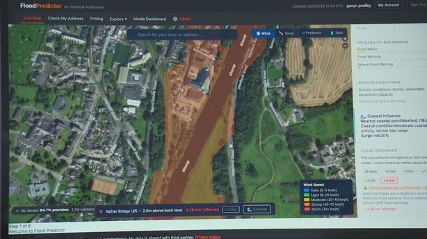
Mr Pedley added information from the EU Copernicus Climate Change service including very detailed lidar maps of Irish topographical contours and landscape.
He even added information and satellite maps from the US Space Agency NASA.
"I spent about a month properly thinking it through, jotting down ideas of how to construct it, and then I started building the first flood prediction model."
"Over the last couple of weeks, we've added machine learning to it, and now we have an incredible level of accuracy for figuring out exactly the probability of a flood in each area," Mr Pedley added.
"In the middle of a flood, you might have a six hour warning. You need to know if it is time to move the car. You need to know if it is time to get the wedding album out from under the TV and put it upstairs.
"You need to know if you must evacuate," he added.
Mr Pedley’s Flood Predictor is freely available on the website floodpredictor.ie.
A related app that will enable people to receive live updates and local flood warnings direct to their phones is to be launched very shortly.
"It's national. I have all the river systems in the country mapped. Full topographical maps of the entire place. Every single flood going back maybe 20 years is there, so people can read what happened last year, or the year before. How was their town affected."
The big question of course is just how accurate is this new flood predictor?
The standard way to test the accuracy of probabilistic forecasting models is to calculate a so-called 'Brier score’.
These quantify how close predictive probabilities are to actual outcomes. They are the same scores Met Eireann uses to check the accuracy of its own weather forecasts.
When it comes to Brier scores, the lower the number, the better. For instance, 0.1 would be a good brier score.
Mr Pedley said his flood predictor has a score of 0.0009 currently. That makes it about 85% accurate. And it will get better every time it gets new information because the model is constantly updated.
He said he does not understand why the State agencies are telling the Government it is going to take another 10 years to develop a local flood prediction service.
It is hard to disagree with him.
We know that climate change means extreme weather is becoming more frequent. Flood risk is rising.
The financial and human cost of inaction was clearly evidenced in Enniscorthy just three and a half months ago.
In such times, surely it is indefensible for the public to be told it will take another 10 years to put a flood warning system in place.
The work of Mr Pedley on his flood predictor model shows that there is no technical difficulty.
The data is there, it's just in different silos, and it requires somebody to take responsibility officially to pull it all together and to give the public the national flood warning system it so desperately needs.


