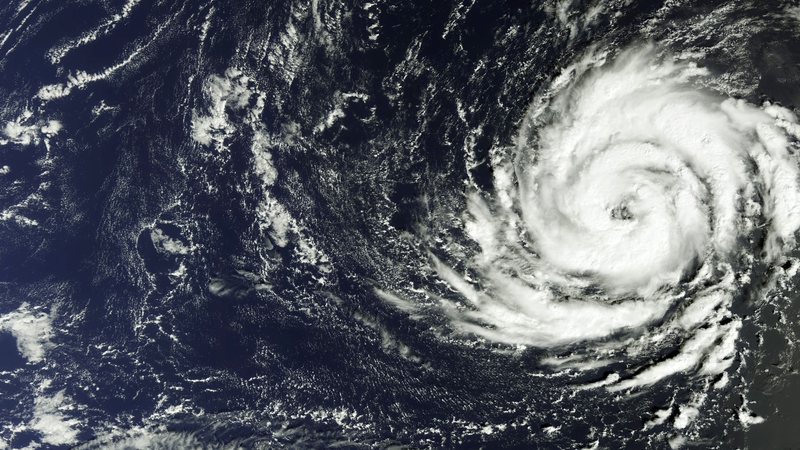
Met Éireann said that Ophelia is the most powerful hurricane to have ever been this far east in the Atlantic on record.
Addressing a meeting of the National Emergency Coordination Committee earlier today Met Éireann said that it expects the eye of the storm may hit the south coast and then track up along the west coast.
The emergency meeting was held to make preparations for Hurricane Ophelia, with storm force winds and heavy rain expected from tomorrow morning.
Heavy rain and storm surges may cause flooding in some areas.
While this is a dynamic storm system, the track of the Hurricane has been very consistent over the last few days and it is not expected to change course over the next few days.
Read more:
- Schools and colleges to close over Hurricane Ophelia
- Buses, ferries and flights face disruption from storm
It is understood Ophelia will hit Kerry at around 6am tomorrow and move up through the country.
It is expected to leave through Antrim at around 9pm.
Met Éireann also warned that structural damage and flooding is possible.
Met Éireann said that at present, the strongest and most damaging winds are now forecast to affect Munster and south Leinster, particularly the southwest, south and Irish Sea coasts - with the heaviest rainfall accumulations in Connacht, west Ulster and west Munster.
Take the opportunity today to secure garden furniture, trampolines, bins, large inflatable minions in preparation for #Ophelia pic.twitter.com/TkAKPGa8wD
— Dublin Fire Brigade (@DubFireBrigade) October 15, 2017
Evelyn Cusack said Met Éireann has taken the unprecedented step of issuing a red alert weather warning.
She said they have been monitoring the track of Hurricane Ophelia along with the National Hurricane centre in Miami, and said Ophelia is currently tracking past the Azores.
She said only 15 storms of this nature have ever been reported within 200 nautical miles of Ireland.