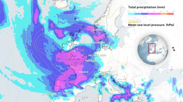
France went on high alert today as Storm Ciarán threatened to bring gale-force winds and extreme rainfall to the north and west, as well as Ireland and Britain.
Three French departments - Finistere, Cotes-d'Armor and Manche - will be placed on red storm alert, the highest level, starting at midnight local time, national weather agency Meteo-France said.
Two of them are will also be placed on maximum flood alert, it added.
A total of 17 departments along the French coast, from the Gironde region to the northern Hauts de France, will be on the lower category orange alert.
The storm will unleash winds of up to 170kmph notably on the coastlines of Britanny and Normandy in the northwest, Meteo-France forecaster Francois Gourand warned yesterday.
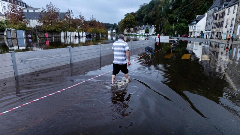
Rainfall could reach 50mm within just six hours, the weather agency said.
Ciarán is expected to hit Britanny before midnight tonight, with winds of up to 150kmph on the coast, and 130kmph inland with a second, more violent, storm phase following some hours later.
Some 3,200 firefighters will be deployed in the most vulnerable areas, the French interior ministry said.
The authorities, warning of falling trees and blocked roads, have urged people to remain indoors if possible and stay away from the coast.
National rail operator SNCF has stopped regional trains in the most affected areas, and also cancelled a number of high-speed TGV rail services.
The airport in Brest, western Britanny, will be closed from the late afternoon today to early tomorrow, and most ferry traffic to Breton islands is to be stopped.
Coastal flooding is likely from early tomorrow, Olivier Caumont, also at Meteo-France, told reporters, with waves possibly rising up to 10m.
Maritime authorities issued a strong warning against taking boats out to sea, or even approaching the coast "be it by car or on foot".
In Ireland, Met Éireann has issued a number of Status Yellow warnings.