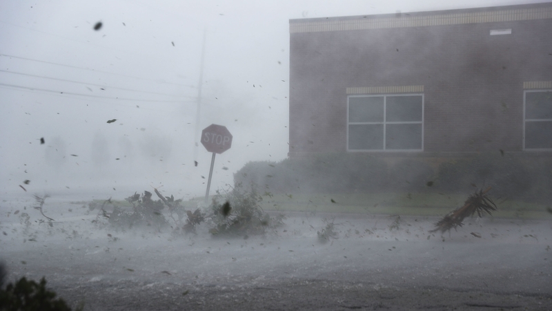
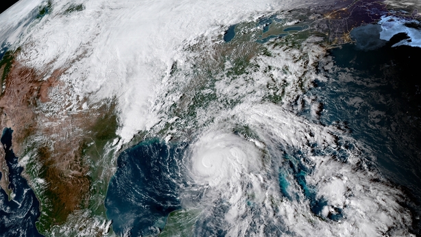
Hurricane Michael, the fiercest storm to hit Florida in a quarter century and the third-most powerful ever to strike the US mainland, has roared into the state's Gulf coast with tree-snapping winds and towering waves.
Michael, whose rapid intensification as it churned north over the Gulf of Mexico caught many by surprise, made landfall early in the afternoon near Mexico Beach, about 32km southeast of Panama City in Florida's Panhandle region, with top sustained winds reaching 249 kilometres per hour.
The storm came ashore as a Category 4 hurricane on the five-step Saffir-Simpson wind scale. Its sustained winds were just 3.2kph shy of an extremely rare Category 5.
As predicted, the storm was downgraded hours later to a still-formidable Category 3 with maximum sustained winds of 205kph and higher gusts as it pushed inland to the Alabama-Georgia border.
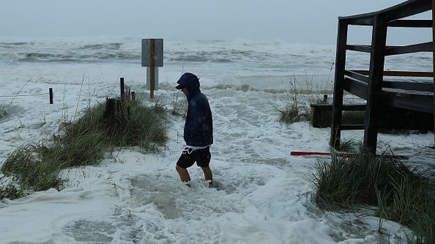
Causing major disruptions to oil and gas production in the Gulf even before its arrival, the storm was forecast to unleash waves as high as 4.3 metres above normal sea levels in some areas, the National Hurricane Center said.
Only a couple of hours after Michael came ashore,floodwaters were more than 2.3m deep near Apalachicola on Florida's Panhandle, National Hurricane Center Director Ken Graham said.
Hurricane Michael strengthens to 'extremely dangerous' Category 4 pic.twitter.com/cF8O9sgOxb
— RTÉ News (@rtenews) October 10, 2018
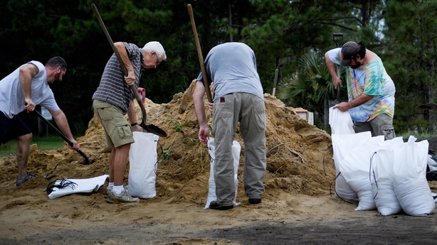
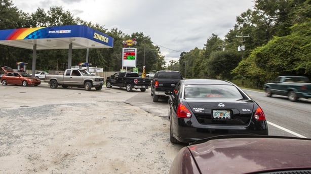
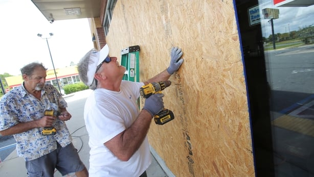
Authorities had urged coastal residents in 20 Florida counties along a 320km stretch of shoreline to head to higher ground before the storm, but anyone who had not fled by this morning was told it was too late to evacuate.
An estimated 6,000 evacuees took cover in emergency shelters, most of them in Florida, and that number was expected to swell to 20,000 across five states by week's end, Brad Kieserman of the American Red Cross said.
FLORIDA - It is imperative that you heed the directions of your State and Local Officials. Please be prepared, be careful and be SAFE! #HurricaneMichael https://t.co/VP6PBXfzm9 pic.twitter.com/aKmaDNgZve
— Donald J. Trump (@realDonaldTrump) October 9, 2018
Even before Michael made full landfall, it was whipping trees with its winds and flooding the town of Port St Joe.
"It feels like you don't know when the next tree is going to fall on top of you because its blowing so ferociously," Port St. Joe Mayor Bo Patterson said.
"It's very, very scary. We have trees being uprooted, heavy, heavy rain."
Mr Patterson said about 2,500 of the town's 3,500 people had stayed put, including about 100 in a beachside area who ignored a mandatory evacuation order.
Early morning view of Cat 4 Hurricane #Michael with 30-second updating vis imagery from @NOAA's GOES-16. @NHC_Atlantic warns additional strengthening is possible before landfall over the Florida Panhandle this afternoon. pic.twitter.com/H3HLzMVi9Q
— NASA SPoRT (@NASA_SPoRT) October 10, 2018
"This happened so quickly, we weren't exactly prepared," he said.
Brock Long, head of the Federal Emergency Management Agency, said early evacuation efforts in the area were slow.
Michael grew from a tropical storm into a Category 4 hurricane over the course of about 40 hours.
"Satellite images of Michaels evolution on Tuesday night were, in a word, jaw-dropping," wrote Bob Henson, a meteorologist with weather site Weather Underground.
US President Donald Trump declared a state of emergency for the entire state of Florida, freeing up federal assistance to supplement state and local disaster responses.
He was briefed by Mr Long in the Oval Office on preparations.
Michael is forecast to move across southeastern Alabama and southwestern Georgia overnight.