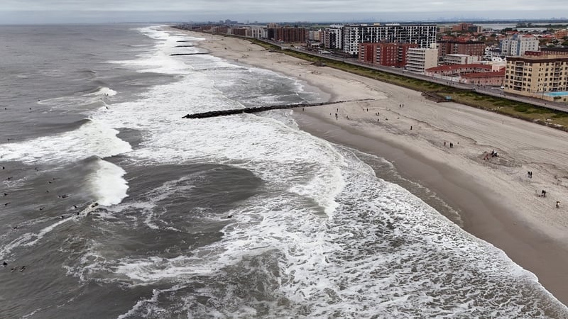
Hurricane Erin has brought coastal flooding to North Carolina and Virginia as it made its closest approach to the US mainland.
High waves washed over the main road to and from the Outer Banks island chain, making some areas impassable, proving the storm's ability to generate dangerous seas hundreds of kilometres from its centre.
Though the Mid-Atlantic bore the brunt of the impacts, the National Hurricane Center (NHC) urged people along the East Coast not to swim to avoid being caught in potentially life-threatening conditions.
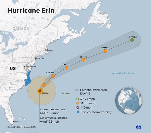
The NHC said that Erin, a Category 2 storm, was packing winds of 169km/h and moving slowly north-northeast.
Authorities warned that the largest swells would continue to whip up life-threatening rip currents from Norh and South Carolina to New England.
The hurricane is expected to weaken as it moves further out to sea in the coming days.
In Bermuda, residents and tourists were told to stay out of the water with rough seas expected until tomorrow.
Erin had strengthened to a Category 5 storm last weekend.
The last system to reach that intensity was Hurricane Milton in October 2024.
The Atlantic hurricane season, which runs from 1 June to 30 November, has entered its peak.
Despite a relatively quiet start with just five named storms, including Erin, the National Oceanic and Atmospheric Administration continues to forecast an above-normal season.
Scientists say that climate change is supercharging tropical cyclones as warmer oceans fuel stronger winds, a warmer atmosphere intensifies rainfall and higher sea levels magnify storm surge.
There is also some evidence, though less certainty, that climate change is making hurricanes more frequent.
Accreditation AFP/Reuters/PA