Tropical Storm Debby is forecast to bring even more rain to coastal areas of the US state of South Carolina, prompting fears of flash flooding in areas already soaked by the slow-moving weather system.
There could be another 23cm of rain in eastern South Carolina, meteorologists said, with total accumulative rainfall in some areas hitting more than 63.5cm since the storm began lashing the southeastern United States on Monday.
While Debby produced less rain yesterday than previous days, National Weather Service Meteorologist Rich Bann warned that today would be different.
"Moisture has pulsed back into Debby," Mr Bann said, noting that the storm picked up water as it spent the last day parked over the Atlantic Ocean off the coast of Georgia and South Carolina.
"As Debby makes its way inland ... the threat of heavy rains will lead to flooding concerns," he added.
Mr Bann said that, by tomorrow, the storm would be dumping up to 10cm of rain on Virginia and Pennsylvania, where ground is already soaked from other storms this week, heightening flooding concerns.
By the weekend, Debby could also produce up to 10cm of rain in central New York state and into northern Vermont.
The storm is located about 35km northeast of Charleston and moving at about 7km/h towards the northwest, with maximum sustained winds of 85km/h.
Additional weakening is forecast today as its centre moves farther inland, the US National Hurricane Center said.
At least six people have died in Florida and Georgia in the wake of the storm, which made landfall on Florida's Gulf Coast on Monday as a Category 1 hurricane and headed northeast.
Governors in the Carolinas, Florida and Georgia have declared states of emergency.
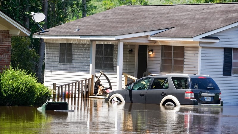
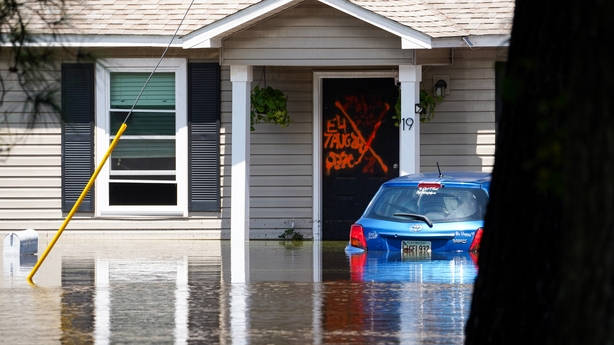
The storm has already left neighbourhoods and communities underwater, washing out streets and inundating homes across the region.
Emergency management officials are keeping a close watch as rainwater drains the numerous river systems in the Carolinas.
The National Water Prediction Service forecast that seven waterways would reach major flood levels before the weather event runs its course.