
The crash site of a rare helicopter has been identified during a survey of Northern Ireland's coastline.
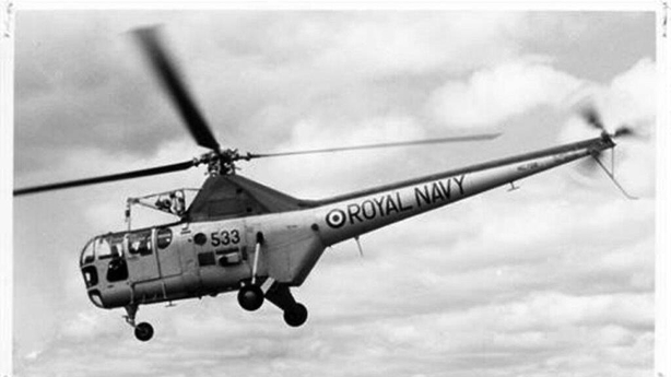
The discovery of the 1950s British Royal Navy Dragonfly helicopter was said to be an unexpected find during the work.
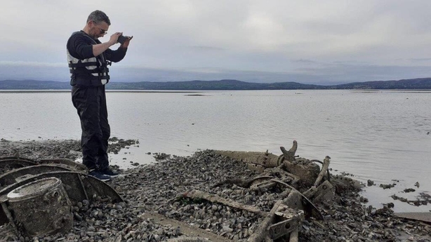
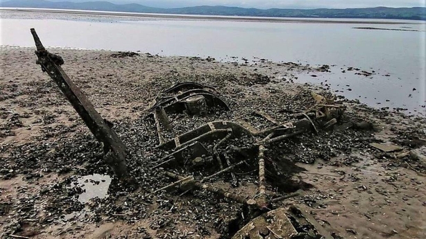
Remnants of an aircraft structure were initially spotted in aerial photos of Lough Foyle and a further physical inspection of the site revealed the wreck of a very early form of helicopter, lying on its starboard side on a gravelly bank.
The heavily corroded frame of the helicopter and its three rotor blades are still mostly intact.
Royal Navy stencilling is still discernible on the helicopter's tail boom.
Further research involving officials from the British National Museum of the Royal Navy in Plymouth, the Fleet Air Arm Museum in Yeovilton and the Ulster Aviation Society, identified the aircraft as a 1955 Westland Dragonfly naval air-sea search and rescue helicopter, based at the Royal Naval Air Station Eglinton, now the City of Derry Airport.
The helicopter had come down on 25 November 1958 during a recovery exercise.
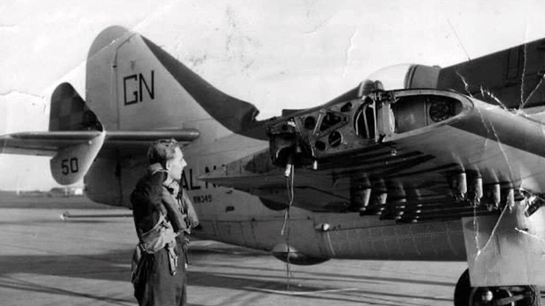
On the morning of Tuesday 25 November 1958, Lieutenant Eric Taylor of 719 Naval Air Squadron left Eglinton Air base on a training sortie to fire rockets at the nearby firing range in Lough Foyle.
Mr Taylor was pulling out of a high-speed dive towards the range when his aircraft hit the slipstream of another Gannet and the outer section of each wing broke away.
He climbed to height and was preparing to bale out when he found he could still control the seriously damaged aircraft and subsequently landed safely at Eglinton.
However later that day, during an operation to recover both Gannet wing tips, a winch cable on the Dragonfly helicopter was cut without warning and the helicopter pitched over, ditching onto its starboard side in the shallow water.
The crash site is "located on dangerous soft sediment and a significant number of potentially live WW2 and post war ordnance surround the site", according to the Northern Ireland Department of Agriculture, Environment and Rural Affairs (DAERA).
A DAERA spokesperson said that the pilot was Lieutenant Commander Eric J 'Porky' Meadowcroft who passed away in 1969.
Both he and his winchman – who was not identified - were unharmed in the incident.
It was found during a survey commissioned by DAERA's Marine and Fisheries Division.
The Topographic LiDAR & Orthophotography survey, completed in early 2022, provides high resolution aerial photographs, near-infrared imagery, and 3D laser scans of the ground surface.
As well as providing detailed information on what our coastline currently looks like, it is also being used to identify man-made structures and landscape features which are at risk from erosion and sea level rise.
Marine archaeologists are utilising this data to identify and assess archaeological and historical sites that lie around Northern Ireland's coastline.
These can include historic wrecks, medieval fish-traps, monastic settlements, castles and fortifications, quays, slipways, and Industrial-era seaweed cultivation sites.
While many of the sites examined are recorded on the Historic Environment Record of Northern Ireland (HERoNI), the research has so far identified over 150 new heritage sites, with 100 of these below the high tide mark and the remainder above.