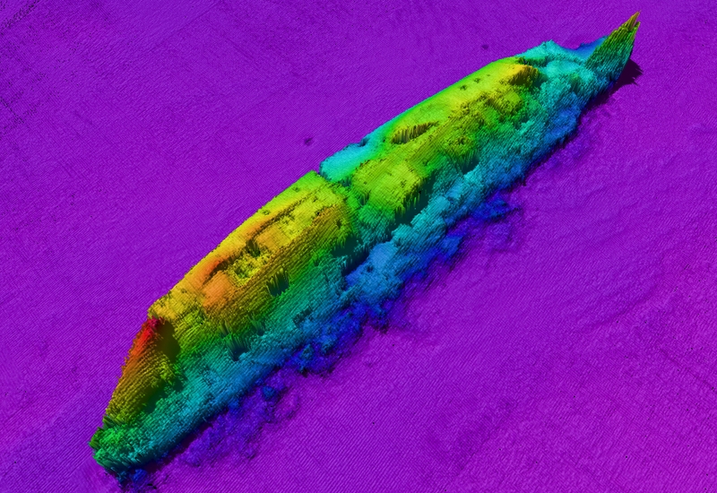
New state-of-the-art sonar images of the Lusitania have been released on the 100th anniversary of its sinking.
The images show the current condition of the RMS Lusitania on the seafloor in greater detail than ever before.
The imagery provides a sense of the scale and history of the site, a tangible connection to the wreck and to the dramatic and tragic events that surrounded its sinking.
The 240m long vessel is clearly defined on the sea floor, lying on its starboard side and standing over 14m high above the seabed.
Members of the Integrated Mapping For the Sustainable Development of Ireland's Marine Resource (INFOMAR) team from the Geological Survey of Ireland and the National Monuments Service of the Department of Arts, Heritage and the Gaeltacht have recently produced and assessed this brand new sonar imagery of the wreck of the RMS Lusitania.
. @RTENationwide focuses on the sinking of the Lusitania tonight at 7pm with guest presenter @bryansixone pic.twitter.com/S1y9cOKPyW
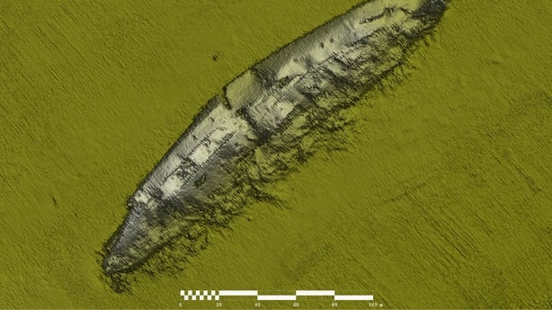
— RTÉ One (@RTEOne) May 6, 2015This new survey data is extremely important from a site protection point of view.
It will add to our knowledge and understanding of the wreck site on the seabed, its current condition and how the site has changed or degraded over the years.
Additionally, the data, in tandem with previous information from individual divers to the site, will be very beneficial in developing our understanding of the physical processes at play at the wreck site and in the surrounding seabed and should help inform long term management strategies for protecting, investigating and conserving the wreck .
One hundred years on, the Lusitania is beginning to reveal its wounds, scars and perhaps its secrets, and may continue to do so for many years to come.