
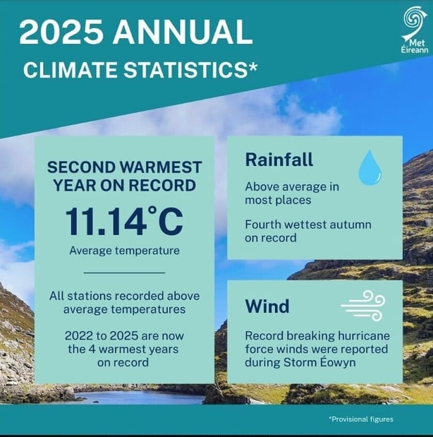
Last year was the second warmest year on record in Ireland since 1900, according to Met Éireann.
In its Annual Climate Statement for 2025, the forecaster said that the average annual air temperature for Ireland last year was 11.14C, while it was 11.21C in 2023.
The long term average (LTA) in air temperature between 1961 and 1990 was 9.55C, while the LTA between 1991 and 2020 was 10.17C.
The forecaster said that the last four years, from 2022 to 2025, were the warmest on record, as well as seven of the top ten warmest years since 2005.
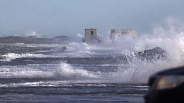
Met Éireann said that there was a cool start to the weather last year before Storm Éowyn brought the highest winds ever recorded.
The highest gust was 99.5 knots (184 km/h) while the highest ten-minute average wind speed was 76.5 knots (142km/h). These speeds were recorded at Mace Head in Galway on 24 January.
Last winter finished warm overall which was followed by the warmest and sunniest spring on record, the forecaster said.
Met Éireann said that 23 out of 25 stations reported their warmest spring on record.
April of last year was the third warmest April on record overall, with 17 stations reporting their highest daily maximum temperature for the month at 25.9C.
The forecaster said that a marine heatwave also developed off the west coast through April and May, with sea surface temperatures over 2C warmer than average in some coastal areas.
Met Éireann also recorded a very warm summer, with five stations recording their warmest summer on record and five other stations having their warmest summer in 30 years.
September was reported as being cooler than average, ending the run of warm months between February and August.
In terms of climate change, Met Éireann said that Ireland's overall warming is continuing in line with the global warming trend.
It said that while last year was relatively dry up until August, the last four months of the year was very wet with a number of heavy rainfall events.
The forecaster said that last autumn was the fourth wettest on record and provisional rainfall data suggests that last year was the 15th wettest year since 1941.
"We experienced five named storms in 2025, as well as a number of impactful rain events," said climatologist Paul Moore.
"The continued warming brings with it the increasing risk of severe weather events."
With the latest climate change projections indicating further warming in the future, Met Éireann said that "temperature change means the likelihood of extreme weather events occurring has increased".
It said that rainfall patterns are expected to change with an increase in dry periods and heavy rainfall events.