The magnitude 7.7 earthquake which struck Myanmar this morning has been detected by seismic instruments stationed in Ireland.
The earthquake hit central Myanmar shortly before 7am Irish time, causing widespread damage across Myanmar and in neighbouring countries.
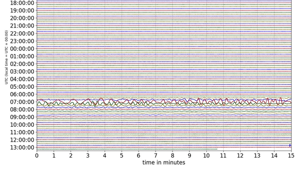
Seismograms shared by the Irish National Seismic Network showed activity shortly after 7am at stations across Ireland.
Seismograms are charts which graph the extent of ground motion across a period of time as measured by a seismograph.
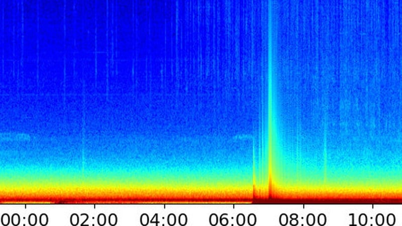
The Irish National Seismic Network also shared spectrograms which show the changes in signal frequencies over time.
Spectrograms in Dublin and Wexford, as well as in other parts of the country, showed notable frequency changes after 7am in the aftermath of the earthquake in Myanmar.
The quake was the highest magnitude earthquake anywhere in the world this year and was also stronger in terms of magnitude than any earthquake recorded in 2024.
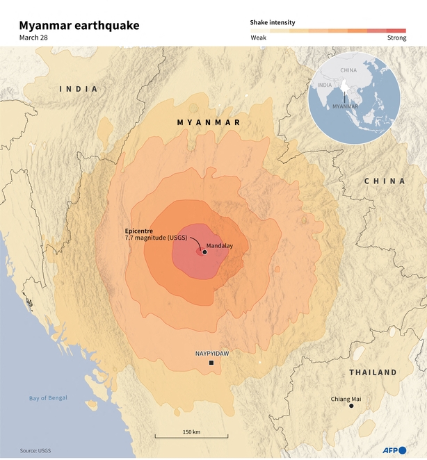
It has caused widespread damage in Myanmar with the full extent of the damage and the overall death toll yet to emerge.
Casualties, infrastructure damage and building collapses have been seen in neighbouring Thailand and China with at least eight dead and over 100 missing following the collapse of an under construction high rise in Bangkok.
A United States government predictive analysis based on the strength and depth of the earthquake in Myanmar estimated there could be thousands of deaths and severe economic loss, with the Sagaing and Meiktila regions worst hit.
Read more:
'Mass casualty' earthquake rocks Myanmar, Thailand