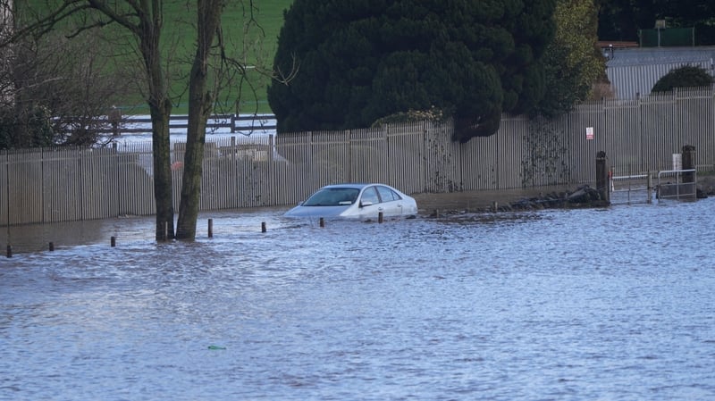
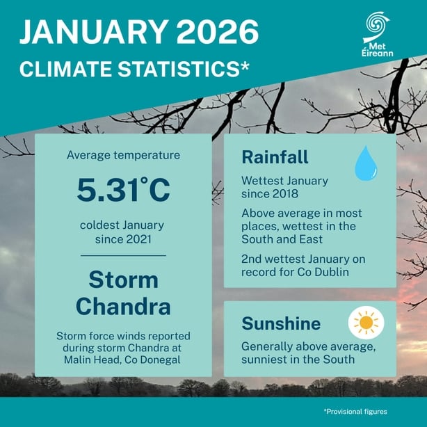
Last month was the wettest January in Ireland since 2018, according to data from Met Éireann.
The climate statement show that, unusually, more rain fell in the east of the country than the west.
It was the wettest January since 1948 - and second wettest on record - in the Phoenix Park and at Dublin Airport.
Met Éireann Climatologist Paul Moore said that January was a "cool month overall, because we [Ireland] were lying for the most part on the northern side of the jet stream.
"We had a very cool start to the month and the actual start of the month was quite dry."
But "overall for Ireland there was 123% of the long-term average rainfall.
"Then there's regional variations ... some [weather] stations in the north and west were actually drier than average, but stations in the south and east were very much wetter than average," he said.
Mr Moore said the Phoenix Park and Dublin Airport recorded more than "220% of their long-term average [rainfall]."
He said the weather station at Johnstown Castle in Co Wexford recorded 230% of its long-term average rainfall last month, making it "the wettest station in the country at 232.7mm".
In "November, December, January, Johnstown Castle in Wexford had 652.5mm, the wettest consecutive three-month period on record.
"Looking at the last three months at Johnstown Castle ... the total for the three rolling months is the wettest at Johnstown Castle going back 85 years," he said.
Mr Moore said that a number of weather stations in the west of Ireland were drier than usual last month because "low pressure systems were coming in from the south ... and they were stalling to our south-west and just meandering northwards.
"So we had a lot of southerly and south-easterly airflow bringing up a lot of moisture from the south and those rainbands concentrated on the south and the east.
In "places, like Belmullet in Mayo, it was closer to the high pressure that was to the north and they only had 88% of their long-term average rainfall.
"So those low pressure systems were stalling because they couldn't move any further east because there was a cold-blocking high pressure over mainland Europe and northern Europe.
"They stalled over us and dropped all the rainfall that came up from the south," Mr Moore said.