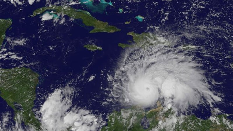
Hurricane Matthew weakened slightly today as it headed towards Jamaica and Cuba, but with winds reaching 250 km/h (155 miles) forecasters said the storm was still powerful enough to wreck homes as islanders braced for its arrival.
Matthew, the strongest hurricane in the Atlantic Ocean since Felix in 2007, was forecast to make landfall as a major storm on Jamaica's southern coast on Monday.
With Matthew about 675 km southeast of Kingston, the US National Hurricane Centre (NHC) downgraded its designation to a Category 4, from the top Category 5, but Jamaican authorities said they were taking all possible precautions.
"The government is on high alert," said Robert Morgan, director of communications at the prime minister's office.
"We hope that the hurricane does not hit us, but if it does hit us, we are trying our very best to ensure that we are in the best possible place," he said.
Disaster coordinators, police and troops are on standby and shelters are being opened across the island, Mr Morgan said.
Despite sunny weather and only a few scattered clouds, many people in the capital Kingston are stocking up on water and food.
Jamaica was hard hit by hurricane Gilbert in 1988, and the last major hurricane in the region was Sandy, in 2012. Matthew could be the most powerful storm to cross the island since records began, meteorologist Eric Holthaus said on Twitter.
Southwest Airlines warned that flights to Montego Bay might be disrupted and said customers could reschedule.
Matthew is also forecast to skim past the southern coast of Haiti on Monday and officials said preparation efforts were focused in the south.
In Cuba, which has a strong record of protecting residents when storms strike, people in the eastern coastal city of Santiago de Cuba said they were following the news closely, although the sky was still blue.