Met Éireann has issued a status orange wind warning for Donegal, Galway, Leitrim, Mayo, Sligo, Clare, Cork, Kerry and Limerick.
A period of very windy weather is expected to develop, with some strong and damaging gusts likely.
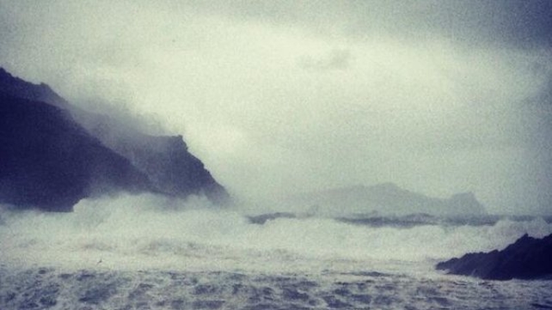
These strong winds will coincide with high seas, along Atlantic coasts, which may lead to some coastal flooding.
Southwesterly winds will reach mean speeds of 65 to 80 km/h while gusts of 110 to 130 km/h are possible, with exposed coasts and higher ground most at risk.
Extreme windy weather expected overnight in Western counties. Gusts of 130km/h. Motorists be aware of vunerable road users, cyclists etc.
— An Garda Síochána (@GardaTraffic) February 22, 2015Winds will veer westerly on Monday afternoon and are expected to ease off later on Tuesday morning.
Meanwhile, a status yellow wind warning is in place for all of Leinster, as well as counties Cavan, Monaghan, Roscommon, Tipperary and Waterford.
In Dublin, car parks at Clontarf and Sandymount seafronts have re-opened after this afternoon's high tide passed without incident.
Dublin City Council said the water level was not as high as expected.
Seafront car parks at Sandymount and Clontarf have reopened after high tide due at 1:47pm wasn't as high as expected pic.twitter.com/7epyBzYJhB
— Samantha Libreri (@SamanthaLibreri) February 22, 2015The council had activated flood defences along the rivers Dodder and Tolka, and placed sandbags along the seafronts in Clontarf and Sandymount due to an expected high tide at 2pm.
Nationwide, conditions are very windy, with southwesterly gusts set to reach a mean speed of between 50 to 65 km/h. Gusts of 90 to 110 km/h are possible. Winds will veer westerly on Monday afternoon. The winds will ease off later on Tuesday morning.
Both weather warnings are in place from until Tuesday at 11am.
A status yellow snow and ice warning is also in place for all of Connacht, as well as Cavan, Monaghan and Donegal.