


The location of Michael Collins's dramatic death is one of the most well known sites in modern Irish history - but what traces are left of that fateful day? Damian Shiels and Niall Murray reveal all
The ambush that took Michael Collins's life at Béal na a Blá on 22 August 1922 is one of the most infamous and controversial events in Irish history. The memory and memorialisation of the event, and of the man himself, remain hotly contested, despite the passage of one hundred years. But what of the physical site?
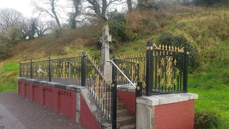
Most people who visit the scene of the ambush today experience Béal na Blá through a brief inspection of Collins’s imposing memorial, erected in 1924 by the National Army in memory of their fallen Commander-in-Chief. Few leave with an understanding of how the ambush developed, or indeed of the archaeology of the ambush site.
It was in an effort to highlight and record such archaeological traces of Ireland’s revolutionary past that the Landscapes of Revolution Project was established. The Project investigates sites from the 1913-23 period to identify what has survived—and what has changed—since the momentous events which defined those years. It also hopes to showcase how a deeper understanding of these archaeological landscapes can influence how we experience, manage and interact with these sites.
Investigating Béal na Blá
It was in this context that, in advance of the centenary of Michael Collins’s death, Cork County Council tasked the authors with using the methodology developed by the Landscapes of Revolution Project to investigate Béal na Blá. Together with analysis conducted by Professor Finola O’Kane Crimmins of UCD School of Architecture, this investigation was intended to increase understanding of the ambush environment and inform plans for the site during the centenary year.
Our purpose was not to provide a definitive account of the ambush, a topic on which much ink has been spilled, or to enter into the debates about the political context or the identity of the man who shot Collins. Rather, we were concerned with locating and - where possible - understanding the surviving traces of the 22 August 1922 landscape at Béal na Blá.
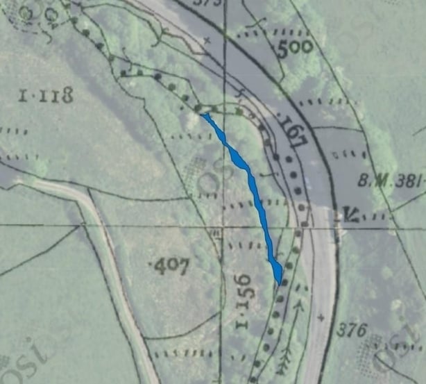
We began by analysing existing historical evidence such as primary accounts, near-contemporary photographs, and mapping, in pursuit of what we call 'locationary indicators’, pointers that allow us to place specific historic events and locations within the modern landscape. The full analysis covered a number of aspects of the Béal na Blá site, but three of the most significant were: the wider conflict landscape, the "upper lane", and the main road, where Michael Collins was fatally wounded.
The wider conflict landscape
The reason why the Béal na Blá ambush occurred where it did is rooted in the significance of this locality during the entire revolutionary period. It is a story that is still visible in the landscape today, written in stone in the form of the numerous historic buildings that dot the area. The 1922 conflict landscape extends well beyond the immediate ambush zone, all the way to Béal na Blá crossroads.
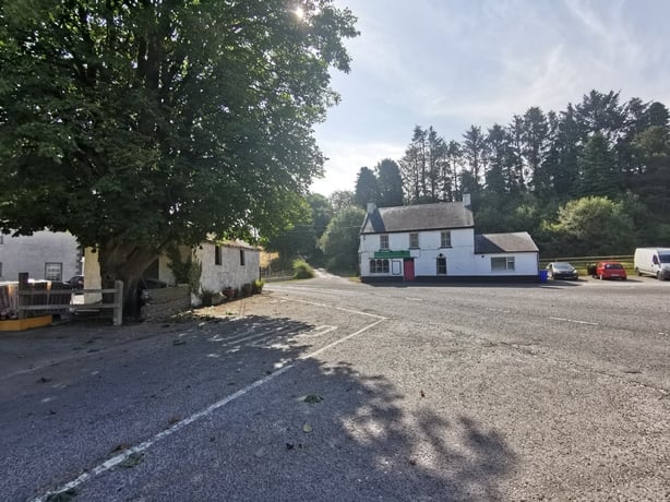
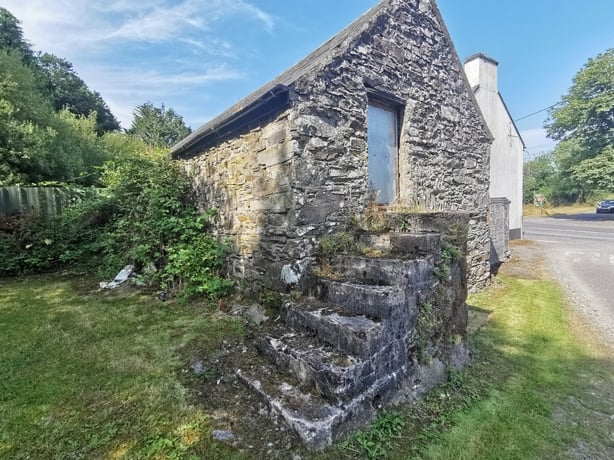
Buildings surviving from the revolutionary period include Long’s Public House (today The Diamond Bar) and the nearby Murray Safehouse, both of which were used to billet Irish Volunteers in 1916 and were regular meeting places for senior IRA officers of the Mid Cork and West Cork Brigades during the War of Independence. Similarly, the Foley Safehouse, located at the south-end of the Béal na Blá conflict landscape, was a venue for meetings and training exercises and frequently used by prominent IRA commanders, such as Tom Barry and Liam Deasy.
The prominence of this area continued into the Civil War, ensuring that in 1922 the area around Béal na Blá was a veritable ‘hornet’s nest’ of anti-Treaty IRA activity. All these buildings were occupied by the IRA on the morning of 22 August 1922, when the Collins convoy first entered Béal na Blá on its outward journey.
Into the hornet's nest
The anti-Treaty IRA in Long’s Pub were preparing for a high-level meeting at the Murray Safehouse scheduled for later that day. It was at the crossroads that Collins was first identified, and in these buildings that plans for the ambush were formulated.
Despite significant later development—Béal na Blá crossroads is now dominated by a service station - this part of the ambush landscape retains a remarkable degree of its historic landscape integrity. The buildings as they survive today would be instantly recognisable to any of the men who took part in the engagement.
The ambush zone - the upper lane
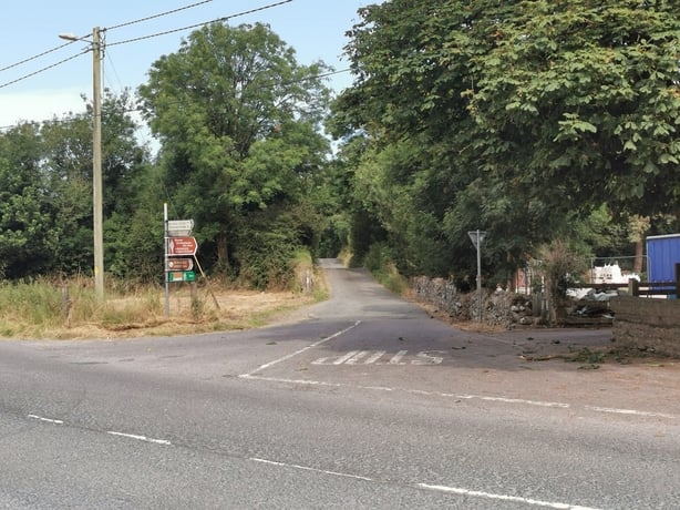
The most significant surviving landscape feature within the ambush zone itself is the primary anti-Treaty IRA position, which we designated ‘the Upper Lane’. This small boreen runs parallel to the main road, situated on high ground off to the west. It was the primary position of the small number of IRA men on the evening of 22 August.
They were providing cover for other members of their unit who, after hours of fruitlessly awaiting the return of the convoy, decided to dismantle the road mine and barricade on the main road. The unexpected arrival of the Collins convoy during this withdrawal sparked the engagement and the Upper Lane became the primary source of IRA fire.
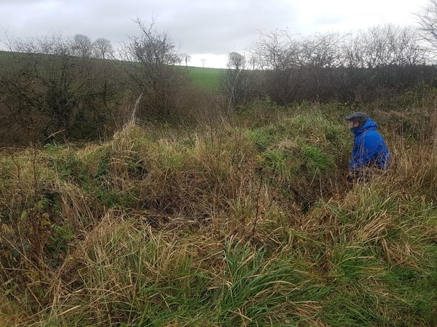
It was also along this lane that Michael Collins saw IRA men moving, prompting him to break cover to engage them. Today, the Upper Lane is little changed from how it appeared in 1922. Most of the ditches which provided both cover and firing positions for the IRA remain in place.
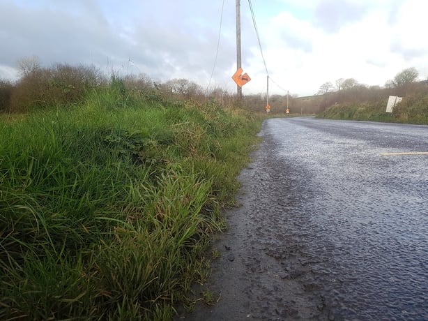
However, there has been a significant increase in tree-growth and vegetation along the banks of the Béalnabláth stream which separates the Upper Lane from the main road. On 22 August 1922 the terrain here was much more open than it is today, offering commanding views of virtually all movement on the roadway below.
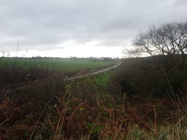
Indeed, in many sections (including that where Michael Collins received his fatal wound) the Upper Lane and main road are separated by significantly less than 100 metres, a distance that represented extremely close range for the weapons employed by both sides during the engagement.
The ambush zone - the main road
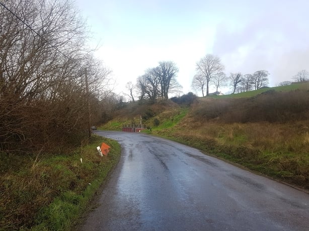
Perhaps unsurprisingly, the part of the Béal na Blá conflict landscape that has undergone the most change since 1922 is in the vicinity of the Collins memorial. While photographic analysis confirms that the embankment behind the stone cross looks much as it did one hundred years ago, the road itself has been significantly altered. These changes were made to accommodate both the memorial and the increased footfall at the site.
Road-widening removed much of the original bend, while the adjacent stream was diverted and canalised. Nevertheless, the portion of the road to the south of the monument does retain something of its 1922 character. Most prominent are the low banks which still line sections of the route, similar in appearance to those behind which Collins, Dalton and others in the National Army convoy took shelter when first engaged.
What then of where Michael Collins was hit? We know that towards the end of the ambush, the Sliabh na mBan armoured car had moved back towards its original position in the convoy, south of the other vehicles and most of the National Army troops – including Collins and Dalton.
At some point thereafter Michael Collins ran for cover to the rear (eastern side) of the Sliabh na mBan, firing occasional shots toward the Upper Lane while trying to ascertain his opponents’ position, and presumably seeking a better vantage point than that offered from the low road-side bank.
After shouting back to Emmet Dalton that some of their attackers were ‘running up the road’, Collins ran about fifteen yards further south from the shelter of the armoured car and most likely sought cover from a position on the ground on the western side of the main road, nearest the stream. Shortly thereafter he received his fatal wound.
After he was struck, Collins was carried back across the road to the position of the Sliabh na mBan (where Lieutenant Smith received a non-fatal gunshot wound to the neck) and ultimately to the touring car for the mournful journey back to Cork.
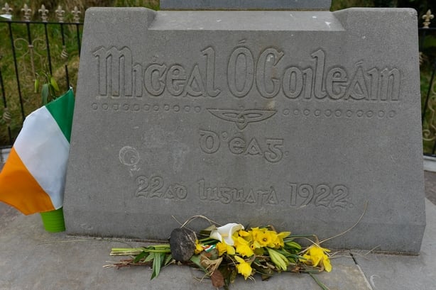
It is difficult to determine the precise spot where Collins first fell, and it is worth noting that he was moved on several occasions. However, the balance of evidence suggests that he was hit on the west side of the road, in an area somewhat to the south of the present-day memorial. If so, despite the alterations necessitated by the development of the memorial in 1924, the actual wounding site retains much of its 1922 integrity.
Examining sites like Béal na Blá from an archaeological perspective, and seeking to identify, record and map surviving landscape elements, allows us to interact with and explore such locations in new ways. In the years to come, the site of Michael Collins’s death will rightfully continue to be regarded as a nationally- important landscape of memory and memorialisation.
But there is also much to be gained by viewing the site through the lens of its surviving conflict landscape. Doing so facilitates a subtle sensory shift, allowing Béal na Blá to serve as both a site of remembrance and one that facilitates a deeper engagement with the events of 22 August 1922 and the wider revolutionary conflict that engulfed the county, and the island, during the decade of revolution.
You can find out more about the archaeological potential of revolutionary landscapes by visiting the Landscapes of Revolution Project website at www.landscapesofrevolution.com.
This article is part of the Civil War project coordinated by UCC and based on The Atlas of the Irish Revolution edited by John Crowley, Donal Ó Drisceoil, Mike Murphy and John Borgonovo. Its contents do not represent or reflect the views of RTÉ.