

Analysis: Ireland's 3,172 kilometres of coastline faces a crisis with plastic pollution so could a detection platform using drone imagery provide a solution?
Plastic pollution is one of those problems everyone can see, yet few know how to tackle it effectively. I grew up walking the beaches around Tramore in Co Waterford, where plastic debris has always been part of the coastline, including bottles, fragments of fishing gear and food packaging.
According to the UN, 19 to 23 million tonnes of plastic every year ends up in lakes, rivers and seas. It has a huge impact on ecosystems, creating pollution and damaging animal habitats. Community groups do tremendous work cleaning these beaches, but they're essentially walking blind, guessing where plastic accumulates, missing hot spots, repeating the same stretches while problem areas may go untouched.
Years later, working in marine robotics at the University of Limerick, I began developing tools to support marine clean-up and help communities find plastic pollution along our coastline. The question seemed straightforward: could we use drones to show people exactly where the plastic is? And could we turn finding the plastic littered on beaches and cleaning it up into something people enjoy – in other words, "gamify" it? Could we also build on other ways that drones have been used previously such as tracking wildfires or identifying shipwrecks.
We need your consent to load this rte-player contentWe use rte-player to manage extra content that can set cookies on your device and collect data about your activity. Please review their details and accept them to load the content.Manage Preferences
From RTÉ Archives, Dermot Mullane reports for RTÉ News on how Tramore is the first town in Ireland to tackle a litter problem with a state of the art beach cleaner (1974)
Building the technology
At the University of Limerick's Centre for Robotics and Intelligent Systems, my team combined drone-based aerial surveillance work with machine-learning algorithms to map where plastic was being littered, and this paired with a free mobile app that provides volunteers with precise GPS coordinates for targeted clean-up.
The technical challenge was more complex than it appeared. Training computer vision models to detect a bottle cap from 30 metres altitude, while distinguishing it from similar objects like seaweed, driftwood, shells and weathered rocks, required extensive field testing and checks of the accuracy of the detection system.
The development hasn't been straightforward. Early versions of the algorithm struggled with shadows and confused driftwood for plastic bottles. We spent months refining the system through trial and error on beaches around Clare and Galway so the system can now spot plastic as small as 1cm. We conducted hundreds of test flights across Irish coastlines under varying environmental conditions, different lighting, tidal states, weather patterns, building a robust training dataset.
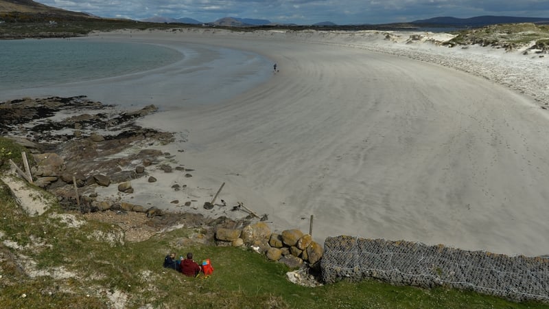
How a drone can detect litter
Ireland's plastic problem
Ireland’s 3,172 kilometres of coastline, the longest per capita in Europe, faces a deepening crisis. The urgency of this work becomes clear when you look at the Marine Institute's work.
A 2018 study found that 73% of deep-sea fish in Irish waters had ingested plastic particles. More than 250 species, including seabirds, fish, marine turtles and mammals have all been reported to ingest large items of plastics. The costs go beyond harming wildlife, and the economic impact can be significant.
Our drone surveys revealed that some stretches of coast accumulate plastic at rates five to ten times higher than neighbouring areas, driven by ocean currents and river mouths. Without systematic monitoring, these hotspots go unaddressed.
We need your consent to load this rte-player contentWe use rte-player to manage extra content that can set cookies on your device and collect data about your activity. Please review their details and accept them to load the content.Manage Preferences
From RTÉ Radio 1, Evelyn O'Rourke reports on the Clean Coasts campaign
Making the technology accessible
The plastic detection platform accepts drone imagery from any source, such as ordinary people flying their own drones. Processing requires only standard laptop software. Users upload footage and receive GPS coordinates showing detected plastic locations. The mobile app, available free on iOS and Android, displays these locations as an interactive map.
Community groups, schools and individuals can see nearby plastic pollution and find it, saving a lot of time. It has already been tested with five community groups around Ireland with positive results, averaging 30 plastics spotted per ten-minute drone flight, varying by location.
Working through the EU-funded BluePoint project, which is tackling plastic pollution of coastlines around Europe, we've distributed over 30 drones to partners across Ireland and Europe, including county councils and environmental organisations. The technology has been deployed in areas including Spanish Point in County Clare, where the local Tidy Towns group (litter-picking volunteers), were named joint Clean Coast Community Group of the Year 2024.
From YouTube channel Propelor BIC, a litter pick organised along the coast of Tramore, Co Waterford
The wider waste story
This is part of a broader European effort to address plastic pollution. Partners such as the sports store Decathlon are exploring how to transform recovered beach plastics into new consumer products – sports equipment, textiles and components.
The challenge isn't just collection. Beach plastics arrive contaminated with sand and salt, in mixed types and grades. Our ongoing research characterises what’s actually found on Irish coastlines, providing manufacturers with data to design appropriate sorting and recycling processes.
The open source software platforms and the drone technology have already been used in nine countries, engaging more than 2,000 people. Pilot programmes are running in France, Spain, Portugal, Brazil and the UK.
What began as a question about making beach clean-ups more effective has evolved into a practical system connecting citizen action to environmental outcomes.
Community feedback from pilots has been overwhelmingly positive. Groups report that the drone-derived GPS coordinates transform clean-up work. One participating Tidy Towns group said that volunteers now head straight to flagged locations.
Groups have also reported increased participation, the gamification aspect appeals to families and participants who might not volunteer otherwise. Additionally, the data we’ve gathered so far is being used by local authorities to understand litter patterns and inform policy decisions around waste management and coastal protection.
Follow RTÉ Brainstorm on WhatsApp and Instagram for more stories and updates
This article was originally published by The Conversation.
The views expressed here are those of the author and do not represent or reflect the views of RTÉ