Analysis: The port's international connections brought much prosperity to the Co Donegal town, but the good times didn't last
By Angela Byrne, Royal Irish Academy
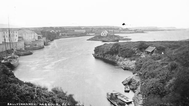
Ballyshannon's quayside may be quiet today, but it was a lively port for centuries that saw traffic to and from Britain, Norway, France, Spain, the Low Countries, the Caribbean, the US and Canada. In the early 15th century, Irish-speaking merchants came from Bristol chasing profits from the rich fisheries.
The trade in fish was particularly important. By the mid-16th century the O'Donnell was known internationally as 'the king of fish', exchanging herring, salmon and ling for French and Spanish wines. On shore, this trade would have supported a fishing settlement where people worked at processing the catch, building boats, mending nets, and portering.
James I granted a lease of the customs of Ballyshannon's imports and exports in 1603, indicating the harbour's growing importance. Developing as an entrepot for the south Donegal–Fermanagh–north Sligo region, butter was loaded at Ballyshannon for export to the Low Countries by the late 17th century and deal timbers were landed from Norway. The port also served the germinating garrison town: English and Dutch guards with 8,000 bushels of oats landed at Ballyshannon in May 1691 bound for the battleground in Flanders.
The 18th century brought increasing prosperity, urban development and a growing professional class. Brewers, maltsters, millers, smithies and tanners provided everyday necessities for the growing population, while distilleries, salt pans, warehouses and stores catered to the fishing and shipping industries. Ballyshannon's merchants capitalised on their existing international connections to establish enduring business dynasties. Thomas 'French Tom' Barton was one of the most successful of these. Having left Ballyshannon for Bordeaux in 1720, Barton made his fortune and continued to trade with home. The vineyards he established in France still operate today.
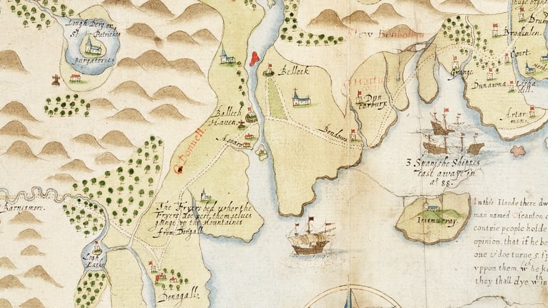
Ballyshannon's merchants became increasingly ambitious in the late 18th century. A new quay was built (now Mall Quay) and representations were made for a canal (never realised) to link Ballyshannon and Belleek, to increase trade with Enniskillen by bypassing miles of perilous rapids on the Erne. In 1778, one of Ballyshannon’s most prominent merchants, Archibald Murray, commissioned a survey of the harbour and proposed improvements to a troublesome sandbar at the mouth of the Erne.
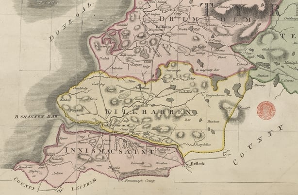
The sandbar was a major feature in the harbour and is recorded on maps from the early 17th century onwards. Its impact on Ballyshannon's trade was well known, and many improvement schemes were devised and suggested. In the 1830s, the Conolly estate paid £5,000 to have rocks removed from the bar mouth, but this did not solve the problem. The Commissioners of Public Works acknowledged that major remedial works were needed, but were not prepared to invest the necessary sum. The sandbar prevented larger vessels from accessing the port and many ships were damaged and even wrecked while carrying cargo and people out from Ballyshannon's piers.
Trade continued to be lively into the 1830s, though, with fish and shellfish packed in ice for export to Liverpool, and salt fish to the Mediterranean. Imports, especially timber, were landed from America, Canada, Norway and Russia. Kelp harvested on the shore was kiln-dried before being exported for use in the manufacture of glass and soap. When improvements in transportation reduced the sailing to Liverpool to just two days, eels were exported in tanks as live cargo.
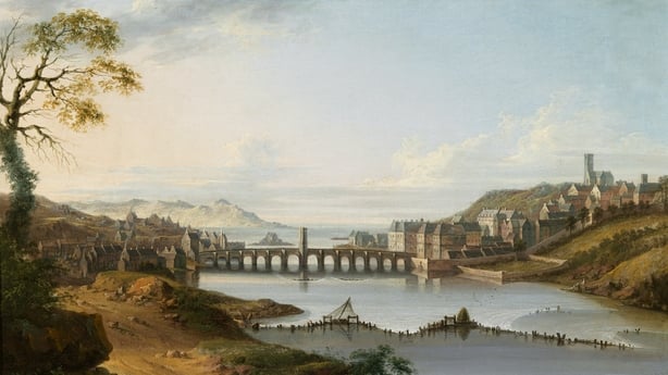
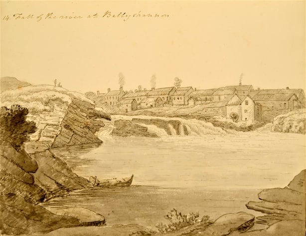
By the time the Ordnance Survey mapped Ballyshannon in 1835, the town had the characteristics of a port with a custom house, an icehouse, slips and piers and imposing warehouses. The maritime tradespeople – rope and twine makers, a ship's carpenter – must have been kept busy. The town’s population mushroomed, increasing by 25% in the decade prior to the Great Famine.
But there could be no increase in trade or shipping as long as the sandbar remained, preventing larger vessels from accessing the narrow channel between the harbour and the Atlantic. The advent of steam and rail travel spelled the beginning of the end for Ballyshannon port. From 1857, the railway enticed emigrants and merchants to look to Derry, where steamships offered faster and more comfortable Atlantic crossings. Ballyshannon could not compete.
Ballyshannon was granted its own harbour authority in 1886, but it was already too late. It quickly became clear that the extent of improvement works needed far exceeded the funding available. The Harbour Commissioners oversaw the maintenance and repairs of Ballyshannon’s slips and quays over the following decades. By the 1930s, though, maritime traffic steadily declined and international shipping at Ballyshannon was all but finished.
In 1879, Hugh Allingham – half-brother of the poet, William – described Ballyshannon as 'suffering from the chilling effects of a diminished trade and a decreased population.' Despite having been one of the principal towns in Co. Donegal for centuries, Ballyshannon’s trade and industries collapsed.
Allingham listed the trades and occupations that had disappeared from his hometown during his lifetime: fish salters, bacon curers, salt manufacturers, brewers, distillers, soap boilers, gun makers, confectioners, nurserymen, breeches makers, dyers, weavers, linen dealers, iron exporters, direct wine merchants, and tobacco and snuff manufacturers. This was a signal of terminal decline and Ballyshannon would no longer be one of Co. Donegal’s windows on the world.
Yet its former standing as a thriving, globally connected port town lingers on. You can see it in the surviving 19th-century warehouses, the fine 18th and 19th-century townhouses, the waterside boatyard and where Mall Quay asks the curious visitor to turn their gaze westward onto the maritime highway of the Atlantic.
Follow RTÉ Brainstorm on WhatsApp and Instagram for more stories and updates
Dr Angela Byrne is a copy editor on the Dictionary of Irish Biography at the Royal Irish Academy. She is the author of Irish Historic Towns Atlas no. 32: Ballyshannon/Béal Átha Seanaidh
The views expressed here are those of the author and do not represent or reflect the views of RTÉ