

Analysis: You might not know it, but Ireland is dotted with extinct volcanoes that have shaped the island we know and love today
We're all familiar with active volcanoes, if only because of Pompeii, destroyed by the eruption of Mount Vesuvius in 79 AD or, more recently, Eyjafjallajökull in Iceland, which caused travel chaos in 2010. But we do in fact have a number of extinct volcanoes on the island of Ireland and the island owes its spectacular landscape and coastlines to volcanic activity.
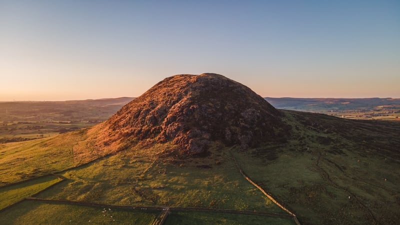
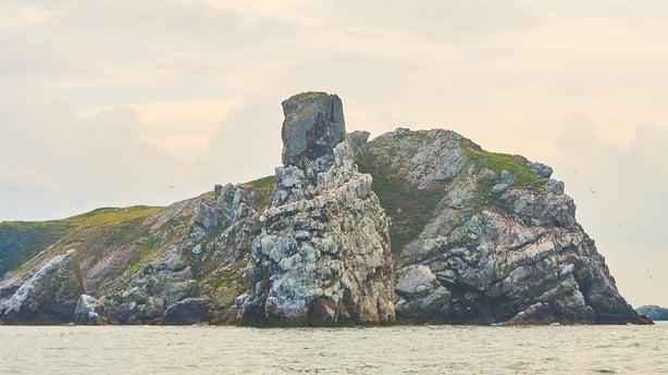
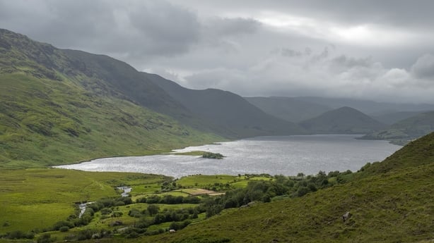
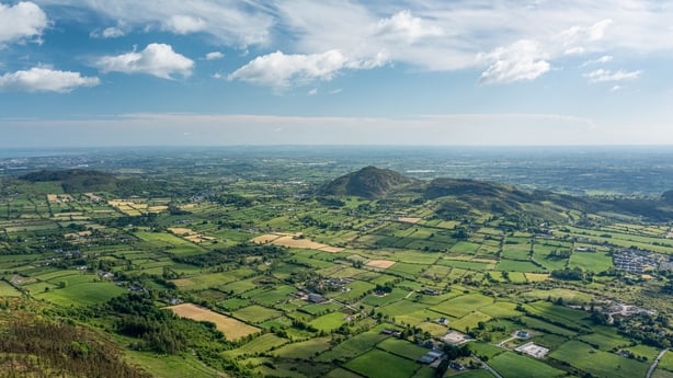
According to Geological Survey Ireland, Ireland's public earth science knowledge centre, familiar sites like Slieve Gullion in Co Armagh, Croghan Hill in Co Offaly, Mount Slemish in Co Antrim, Lambay Island off the coast of Dublin and Loch Na Fooey in Co Galway, are all extinct volcanoes.
And "for a small island, we're very, very fortunate with the variety of geology we have," says Dr John Reavy, senior lecturer in geology at University College Cork. "What we have is a mosaic, or collage, of different rock types from different settings which you now see exposed on this island."
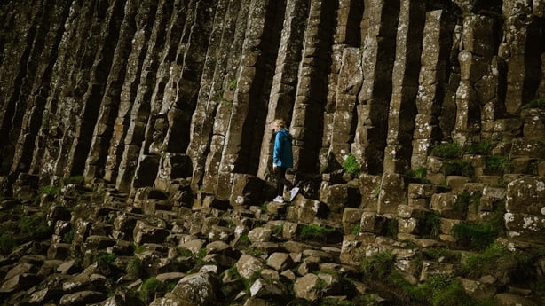
A lot of the dramatic landscape in Antrim, like the Giant's Causeway for example, was formed, not by volcanoes as such, but by "fissure eruptions or cracks in the earth because at that time continents were being split apart by a massive amount of heat coming up from the mantle." This happened a whopping 60 million years ago, which was also the last time we saw any volcanic activity around these parts. But, as Reavy explains, this is actually very recent geologically speaking.
At that point, volcanic activity caused the opening of the North Atlantic Ocean and a huge mass of hot material in the mantle rose up and split Greenland, Europe and North America apart. That sort of activity is called a plume and that's what’s still causing the current activity we see in Iceland today. "It hasn't moved it's just the continents have moved above it," he explains.
But, just to be clear, the extinct volcanoes on the island won’t erupt again (this is obvious, given they’re extinct). "No chance of that," says Reavy. "Since the Atlantic opened, it’s been very stable. We’re not near a plate boundary."
To explain a little about what geologists call igneous rocks, there are, generally speaking, two types: igneous intrusions or igneous extrusions. When tectonic plates collide or oceans open, the Earth's mantle and parts of the crust melt, and when they melt they form a material called magma, explains Reavy.
If the magma crystallises below the surface it’s called an igneous intrusion (because it’s intruded into the rocks around it) and it will look like granite, with its coarse grain and large crystals that formed because it cooled slowly. If the magma gets all the way to the surface, erupts as lava, and crystallises there, it’s called an igneous extrusion, or volcanic rock. An example of that is basalt (like the Giant’s causeway).
The rocks around the Mourne Mountains in Down, Carlingford in Louth and Slieve Gullion in Armagh are of a similar age to those in Antrim. "They're the root zones of volcanoes, but the magma there didn’t actually escape at the surface, it crystallised below the surface and what was above it eroded away." These are igneous intrusions, rather than volcanic rocks (igneous extrusions). Another site of igneous activity in Ireland are the granites we see in Donegal, Conamara and Galway, as well as Wicklow. These rocks are about 400 million years old.
"But there's a series of volcanoes in parts of Galway, Loch na Fooey for example, and there's definitely volcanic rocks there. There's some just north of Dublin as well. There's areas there where there would have been volcanoes," says Reavy.
In other parts of the world, like the Aleutian islands in Alaska, or some of the islands you get around the Caribbean or the Philippines, you get chains of islands from volcanic activity, he explains. Crust is destroyed under other oceanic crust and you might get an arch of volcanoes above the surface of the ocean. "That would be a a setting where you have two plates colliding and you have one plate pushed out under another plate and the result of that is that you get melting in the mantle, and that then rises up and produces a chain of volcanoes."
Loch na Fooey in Conamara and Lambay Island in Dublin, which are over 470 million years old, are two examples in the Irish landscape of that type of volcanic activity. There could also have been a surface volcano with a caldera at Slieve Gullion. The ring of Gullion, with its circular topographic feature, could represent material which was coming up around around the caldera, Reavy says. "Slemish (in Antrim) could have been a plug which was feeding lava up to the surface and is now standing up there."
"The range of rock types of all ages [on the island of Ireland] is quite phenomenal," he says. "Because these rocks seem to have happened to be involved in lots of different activity, at different places, at different times," he says. "If you go somewhere like Hudson Bay in Canada, you could see exactly the same rock type for millions of square kilometres because that's been a stable continental block for maybe 2 billion years."
"But we just happen to have caught all the action because we were in the right place, at the right time, where lots of things were happening. Oceans were opening, oceans were closing, and we were just caught in the middle of all these tectonic movements."
This is why we owe so much of our natural heritage to volcanic activity. As the Earth's crust moved around the surface, different parts of what is our island today formed. "So when you talk sometimes about 'Ireland had a desert climate, or Ireland had a tropical climate', it doesn't mean at this latitude," says Reavy. "For example, some of the granites in Donegal or Conamara, were formed during a plate collision, but the plate collision was south of the equator. Then, later on, by the time the Antrim lavas erupted, we had moved much further north."
READ: The science of earthquakes in Ireland
"A lot of the rocks around Munster, the sandstones you get in Cork and Kerry, they formed in big river systems at southern latitude deserts. Then the rocks you get in the Burren, like limestones, formed in tropical seas because we were at tropical latitudes," he explains. "As these bits of crust have moved around the globe, you’re getting different rock types in different settings because you were in different climate zones."
"So there is a gradual northward drift as all these collisions, ocean openings and ocean closures are happening. We are now at this present latitude, at the edge of Western Europe, but we have gradually been moving northwards throughout geological time."
Follow RTÉ Brainstorm on WhatsApp and Instagram for more stories and updates
The views expressed here are those of the author and do not represent or reflect the views of RTÉ


