What's the difference between a nimbostratus and an altocumulus cloud? What about a horseshoe vortex or a contrail? This is what Gavin Pretor-Pinney, Author and Visiting Fellow at The Department of Meteorology, University of Reading, has set out to explain in his book Cloudspotting for Beginners. He joined RTÉ Radio 1's Today with Claire Byrne to talk about different types of clouds and why we should pay more attention to the sky above us. (This piece includes excerpts from the conversation which have been edited for length and clarity - you can hear the interview in full below).
We need your consent to load this rte-player contentWe use rte-player to manage extra content that can set cookies on your device and collect data about your activity. Please review their details and accept them to load the content.Manage Preferences
"It's funny how when something's in your vision the whole time, like the sky is, it's easy to become blind to it," says Pretor-Pinney. 18 years ago he set up the Cloud Appreciation Society. "The sky and the clouds are something I've always felt get a bad rap. People complain about them too much. And I've always felt that you only need to stop and think about them for a moment and you realise, well, the sky's one of the most beautiful parts of nature. It's ever-changing. It's nature's abstract art."
"We talk about someone having a cloud hanging over them or a cloud on the horizon, these negative associations - but think where we would be without them? It wouldn't be actually so good. Because they help to cool the planet, they bring us fresh water, they clear the atmosphere of dust and pollution. We should appreciate clouds, and that's really why I set the society up."
From TEDEd, writer and historian Richard Hamblyn explains how clouds got their names
What are the main types of clouds?
There are 10 main types of clouds. There's the Cumulus cloud, otherwise know as the Simpsons' cloud. "The cartoon cloud that forms on a sunny day. The fair weather cloud. It's like the generic one, really. If you close your eyes, you're probably thinking of a Cumulus," he says.
There's the Cirrus cloud. "The high, wispy ice crystals that are cascading from the upper reaches of the troposphere. They look like brush strokes across the blue." In contrast to the Cirrus clouds, there's the Cumulonimbus storm cloud, "which reaches up maybe eight miles into the sky, spreads out at the top in an enormous anvil shape, and produces thunder and lightning, and sometimes hail."
Then there's the one you might "want to boo" when it appears in the sky. "The nimbostratus is the one that gives all the other clouds a bad name. It's a sort of low, thick, wet blanket of the sky, and it produces rain or snow, but it's continuous. So, the cloud hangs around a long time, like all the layer clouds do, and this one is one that produces quite a lot of precipitation, which can persist." We might not appreciate the nimbostratus very much in this part of the world, but in the arid region of the world, it would "be your best friend," says Pretor-Pinney.
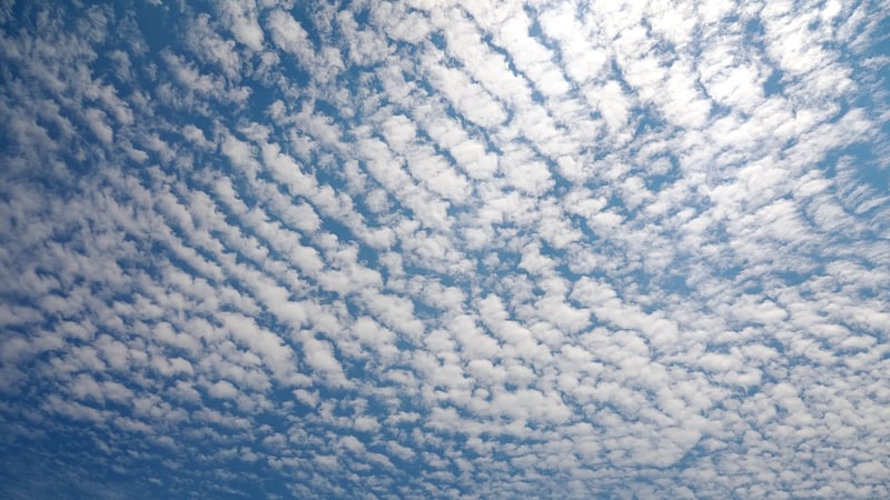
The other main types of clouds are: Cirrocumulus, Cirrostratus, Altocumulus, Altostratus, Stratocumulus, and Stratus.
What about those pink, rolling clouds we sometimes see at sunset?
"When the sky looks dramatically pink or golden, of course it's when the sun's low on the horizon. It's when the sun is shining up onto the underside of clouds, usually. And that is a moment of magic, when it comes to the sky," he says. "Because we instinctively know it's a fleeting moment, a sunrise or a sunset."
"And the reason is, because if the sky's clear off to where the sun is on the horizon, it can shine across the sky to the clouds above you. But it can only shine up and illuminate their bases with the golden and ruby hues of sunrise or sunset for a moment. Because the angle's right only for a brief period of time as the sun is near the horizon to light up the undersides," he explains.
From TED, Gavin Pretor-Pinney on nature's finest aerial architecture
Clouds are constantly moving and changing
"Unless it's really wild, stormy weather, you look at the sky and you think, 'Oh, it's all so stationary, pretty much, the clouds.' But then you only need to look away for a brief period and look back, maybe comparing them to something fixed like a tree or something, and you'll see that they've moved," he says. "They are the most ephemeral of nature's displays."
What about tornado clouds?
Pretor-Pinney also explained how the Cumulonimbus cloud is one of the ingredients required for a tornado to form. "These actually can combine together into a kind of mob behaviour, these cumulonimbus clouds, when they act as individual cells within a larger storm system. And if those cells get really, quite organised in terms of the flow of air into and out of them, you end up with what's known as a supercell storm, and this can have a large rotating central region to it. It's called a mesocyclone."
Read more: Tornadoes in Ireland: yes, we get them and here's how many
"The base of this is where you're going to be looking for a tornado. And one particular part of it extends down. It's known as a wall cloud. And the wall cloud, Murus is the Latin name, that is the breeding ground for tornadoes. Because that's where the rotation beneath this cloud picks up most energy and where it can take on most vorticity. And that is where a tuba - it's like a finger of cloud extending down from the base of the storm system - can develop. The tuba is the first sign of a tornado born within the wall cloud of a supercell storm."
Follow RTÉ Brainstorm on WhatsApp and Instagram for more stories and updates
The views expressed here are those of the author and do not represent or reflect the views of RTÉ