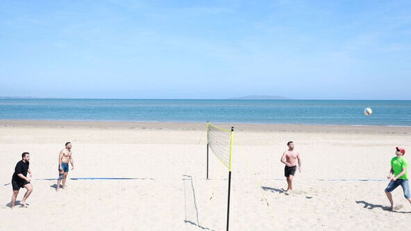
Analysis: The great weather we're currently enjoying is down to a a blocking area of high pressure sitting just to the north of Ireland
Ireland is enjoying some unusually dry, warm and sunny weather this spring and early summer so what's the story with the 'Omega block' behind it? Will it continue? And does this mean we're in for a decent summer? Met Éireann climatologist Paul Moore explains all
The fine weather is set to be continue. What's causing it?
The current spell of fine weather is due to a blocking area of high pressure over and just to the north of Ireland and the UK. This particular type of blocking pattern is called an Omega Block because the jet stream makes a pattern that resembles the Greek letter omega.
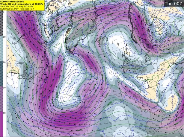
It forms when the jet stream is weak and meanders from north to south ending up with stationary high pressure sandwiched between two low pressure systems to the east-southeast and west-southwest of where the high pressure is located. It can be a stable blocking pattern which lasts for an extended period of time and is quite common on the eastern edges of the North Atlantic and North Pacific.
We've had an unusual run of fine weather this spring. Is this due to any particular meteorological event?
High pressure, in varying positions relative to Ireland but mostly just to the north, has dominated our weather for most of spring 2025 so far (climatological spring is seen as March, April and May). Every time low pressure has tried to take hold, it seems high pressure has re-established itself before long close to or over Ireland and the UK.
The only extended period where Atlantic low pressure gained control of our weather this spring is between Sunday April 13th and Friday 25th when we saw several spells of heavy rain, especially over the Midlands, South and East. Following this unsettled period, high pressure re-established itself to the north and east of Ireland and brough the warmest period of the spring so far at the end of April when the national maximum temperature record for April was broken at Athenry, Co Galway.
We need your consent to load this rte-player contentWe use rte-player to manage extra content that can set cookies on your device and collect data about your activity. Please review their details and accept them to load the content.Manage Preferences
From RTÉ Radio 1's Today with Claire Byrne, weather update from Elizabeth Coleman, Deputy Head of Forecasting with Met Éireann
It cooled down a bit through early May when a weak cold front moved south over the country introducing a cooler airmass, but high pressure again re-established itself over and to the north of the country following this. Over the last four days, a slack area of low pressure tried to push up from the south, creating instability that activated some showers and thunderstorms over parts of the country, but blocking high pressure is again re-establishing and intensifying over and just to the north of Ireland and the UK over the coming days.
What does this have to do with the Stratospheric Polar Vortex?
The reasons behind high pressure systems continuously re-establishing themselves close to our shores this spring are complex, but a contributing factor is the early breakdown of the Stratospheric Polar Vortex in March. The Stratospheric Polar Vortex forms every autumn high up in the stratosphere over Polar regions, when the sunshine reaching the Polar stratosphere decreases, intensifying the temperature gradient between the cold polar stratosphere and tropical stratosphere.
This contrast creates what is called the Polar Night Jet, a powerful jet stream high up in the stratosphere the circumnavigates the north pole from west to east centred around 60°N (not to be confused with the North Atlantic jet stream, which is much lower down). Both Stratospheric Polar Vortex and associated Polar Night Jet winds remain through the winter and can add westerly momentum to the North Atlantic jet stream, lower down in the upper troposphere, sometimes contributing to an active storm season for us.
From NOAA Climate, the stratospheric polar vortex in the first three weeks of March 2025
The Stratospheric Polar Vortex naturally breaks down every spring, on average in mid-April, when sunlight returns to the Polar regions, warming the atmosphere. This year, the Stratospheric Polar Vortex broke down on March 9th, over a month earlier than average.
For us in the mid-latitudes when the Stratospheric Polar Vortex breaks down, it can act like a pattern reset. Taking away the westerly momentum from above can initiate a weakening in the North Atlantic jet stream, which begins to meander from north to south, creating blocking high pressure systems. The influence of the breakdown of the Stratospheric Polar Vortex on the troposphere can last for two to three months. Occasionally, when the overall pattern resets with a weakened North Atlantic jet stream, these blocking high pressure systems can form over Ireland and the UK, which is what has happened this spring, with high pressure re-establishing over and over again in roughly the same place.
Met Éireann's seasonal outlook talks about 'above average temperatures' for June to August - are we in for a warm summer?
The Seasonal Outlook for June July and August, mostly based off the Copernicus C3S seasonal charts, has a strong signal for higher than average temperatures for Ireland during the summer months. However, the signal for rainfall is unclear, suggesting there is an equal likelihood of a wetter or drier than average summer overall. Climatological drought conditions are ongoing at a number of our stations across the country currently, but it is uncertain if this will continue into the summer months.
We need your consent to load this rte-player contentWe use rte-player to manage extra content that can set cookies on your device and collect data about your activity. Please review their details and accept them to load the content.Manage Preferences
From RTÉ Archives, Colm Connolly reports for RTÉ News in 1976 on how people were coping with the summer heatwave's soaring temperatures
Farmers are giving out about a lack of rain and a knock-on impact on grass growth - any good news for them?
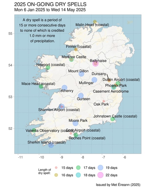
Current indications are that the mostly dry conditions will stick around for at least another week. It has been a very dry, warm and sunny spring so far. Four stations (out of our 25 primary stations), including Malin Head, Co Donegal (record length 69 years), are already seeing their warmest spring on record, with the second half of May, normally the warmest part of spring, still to come.
15 stations are already seeing their highest mean maximum temperatures for spring on record. Most sunshine recording stations have already seen more sunshine in the first two weeks of May compared to all of May 2024.
Climatological dry periods* are currently ongoing at a number of stations, with climatological droughts ongoing at seven stations (lasting between 17 and 18 days) and dry spells ongoing at a further two stations (lasting between 17 and 19 days). There have been 42 separate Climatological dry periods* observed in Ireland so far during 2025, mostly during spring.
We need your consent to load this rte-player contentWe use rte-player to manage extra content that can set cookies on your device and collect data about your activity. Please review their details and accept them to load the content.Manage Preferences
From RTÉ Radio 1's News at One, how are farmers affected by the warm weather?
All this sunshine and relatively calm weather that we are having during spring so far, along with higher global temperatures due to climate change, has led to the sea surface temperatures around our coasts and over the Atlantic to the west and south of Ireland, being much warmer than average. In 2023, similar high SSTs in May led to a marine heatwave in June. That marine heatwave was subsequently linked to the record warm June in both Ireland and the UK and enhanced convective rainfall through stronger, warmer and moister sea breezes.
*Climatological dry periods are classified as dry spells, absolute droughts and partial droughts. The definitions of which depend on the spell duration and deficiencies in the total daily amounts of rainfall. An absolute drought is often part of a more extensive dry spell and in prolonged droughts, two or all three categories may overlap and in some cases coincide.
A climatological dry spell is a period of 15 or more consecutive days to none of which is credited 1.0 mm or more of precipitation. A climatological absolute drought is a period of 15 or more consecutive days to none of which is credited 0.2 mm or more of precipitation. A climatological partial drought is a period of at least 29 consecutive days, the mean daily rainfall of which does not exceed 0.2 mm.
Clearly, weather patterns change from year to year but are there any long-term trends of note?
Some studies have suggested that weather patterns are getting stuck for longer due to climate change, but more research is needed on that front. This current setup, although rare, is mostly due to the natural variations of weather patterns from year to year. However, when we get a situation like this that may not occur very often in Ireland, the extremes within that setup are exasperated by climate change.
As global temperatures continue to rise due to anthropogenic climate change, the likelihood of extreme weather events occurring in Ireland has increased. Irish rainfall patterns are expected to change, with an increase in both dry periods and heavy rainfall events.
More severe agricultural and ecological droughts are projected under climate change; the more the planet warms, the more severe and widespread the drought impacts will be. Heat extremes are likely to be warmer and more frequent. The TRANSLATE project is a Met Éireann lead initiative to standardise future climate projections for Ireland and develop climate services that meet the climate information needs of decision makers.
Follow RTÉ Brainstorm on WhatsApp and Instagram for more stories and updates
The views expressed here are those of the author and do not represent or reflect the views of RTÉ