
Met Éireann climatologist Paul Moore explains what's behind the gloomy, cloudy weather we've seen this month so far
Ireland normally gets between 1,100 and 1,600 hours of sunshine each year. The sunniest months are May and June when sunshine duration averages between 5 and 6.5 hours per day over most of the country. The extreme southeast gets most sunshine, averaging over 7 hours a day in early summer. December is the dullest month, with an average daily sunshine ranging from about 1 hour in the north to almost 2 hours in the extreme southeast. Over the year as a whole, most areas get an average of between 3 1/4 and 3 3/4 hours of sunshine each day.
Overall, there have been 10 instances on record since 1941 where the number of consecutive days without sunshine exceeded 11 days, at various stations. The longest recorded stretch of consecutive days without sunshine since 1941 at a station in Ireland is 16 days. This has occurred twice, once at Belmullet, Co. Mayo between September 1st 1956 to September 16th 1956 and, more recently, at Cork Airport between December 23rd 2018 and January 7th 2019.
Dublin Airport's record for consecutive days without sunshine stands at 11 days which happened in March 1969. But this record has now been tied with Dublin Airport recording zero sunshine this month between Saturday February 8th and Tuesday February 18th. We finally saw some sunshine today, Wednesday February 19th, so the record will remain at 11 consecutive days.
We need your consent to load this rte-player contentWe use rte-player to manage extra content that can set cookies on your device and collect data about your activity. Please review their details and accept them to load the content.Manage Preferences
From RTÉ Radio 1's Drivetime, how much does the weather affect our mood?
So what's behind the gloomy, cloudy weather we've had for much of this month so far? On Thursday February 6th, blocking high pressure over Ireland moved towards southern Scandinavia and introduced a colder easterly airflow over Ireland that originated from central Europe.
At this time of year, when relatively cold and stable air comes from the east over the North Sea and then the Irish Sea, it picks up moisture, leading to a shallow cloudy layer that can feed onto the east coast of Ireland, breaking up at times as it moved west. This along with low pressure to the south of Ireland sending weak weather fronts north into the easterly flow kept it cloudy for several days up to Tuesday February 11th.
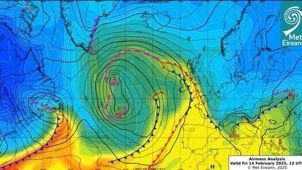
Between Wednesday 12th and Tuesday 18th, the winds turned more southeasterly, and Ireland became the battleground between the cold block to the east and Atlantic weather fronts encroaching from the west. Low pressure stalled to the west in the mid-Atlantic as it couldn’t make further progress east due to the blocking high pressure over Europe and Scandinavia. This meant that the weather fronts associated with the low pressure in the Atlantic stalled and died out over Ireland, bring a lot of cloud, but not much rain.
This pattern finally broke down today (Wednesday 19th) as a cold plunge in the United States acted to intensify the jet stream moving into the Atlantic, which in turn moved the stalled weather fronts further east allowing some sunshine to break through in the East of Ireland. It also marks the beginning of a more typical Atlantic dominated spell of weather with more wind and rain, but also sunny gaps in between.
Follow RTÉ Brainstorm on WhatsApp and Instagram for more stories and updates
The views expressed here are those of the author and do not represent or reflect the views of RTÉ