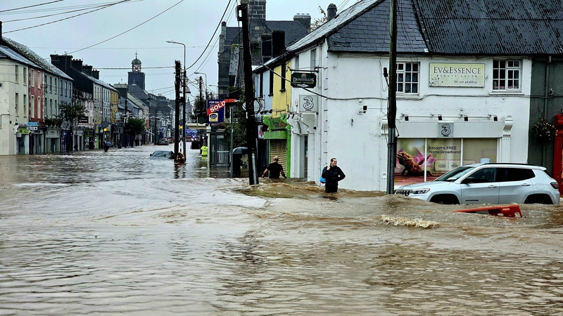
Major flooding events in Cork, Waterford and Kilkenny in recent days have raised questions about Ireland's weather-warning system and whether improvements can be made to mitigate against weather-related damage to businesses and homes.
Despite prior yellow and orange warnings that the risk of flooding was a possibility due to Storm Babet, some businesses and organisations suffered severe damage to their premises and equipment.
So how does Ireland’s weather-warning system work and is it fit for purpose?
Met Éireann has three colour coded weather warnings - red, orange and yellow. Each denotes a weather event of differing severity.
Yellow warns of localised danger, orange flags potentially dangerous or disruptive conditions while red indicates an extremely dangerous or destructive weather event.
The warnings are generalised, meaning entire counties are included under the same warning, which often caution of localised flooding without being more specific.
Met Éireann has issued 211 weather warnings so far this year, a figure that includes cases where, for instance, a yellow warning about a weather event is upgraded to orange.
Last week Cork was under a status orange weather warning, but some business owners in the worst-affected parts of the county said that they were unprepared for the sudden deluge of their premises.
"It came so fast, people were inside having lunch, finishing up. Next minute it came in the back door and it came in like a river. The place is destroyed, all the furniture is gone," said Lynda Corigliano from La Trattoria restaurant in Midleton.
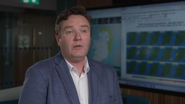
Met Éireann says that its weather-prediction modelling, which is the basis for its forecasting, is the type most suited to Ireland, but is not infallible.
"The reliability of the model depends on the event you're talking about," Met Éireann’s Forecasting Services Manager, Dr Alan Hally, told Prime Time.
"If we're talking about a low-pressure system that comes across the North Atlantic and in over the island of Ireland, those things are generally forecastable on a timescale of three to four days ahead. Whereas something like a thunderstorm that people will have experienced in June, the models aren't as reliable when it comes to forecasting those."
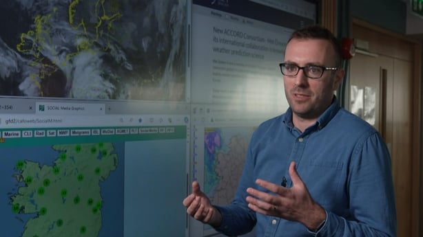
Met Éireann's Head of Forecasting Eoin Sherlock also says that communication around the severity of weather warnings could be improved.
"Orange events can cause serious flooding. Trees can come down and unfortunately, people can be killed. I think we have to do a little bit more in terms of educating the public that an orange event is serious," Mr Sherlock said.
While the current warning system is well-established, Mr Sherlock says Met Éireann is constantly working to improve its own infrastructure in order to provide better forecasts and more localised warnings to relevant authorities.
It also says it is currently working towards adopting a new system called an "impact-based warning."
"That will be saying what the weather will do, trees will fall down, electricity might go out, rather than what the weather will be. That's in line with international best practice," Mr Sherlock said.
Climate change means that it is highly likely that extreme weather events like the flooding in Midleton will become a more frequent occurrence in Ireland over coming years which is why improvements to forecasting has become a key focus for Met Éireann.
"What we can say with a high degree of confidence is we will have more extreme rainfall events, and that's what we've seen already," Mr Sherlock says.
Dr Mary Bourke, Associate Professor in the Department of Geography at Trinity College Dublin echoes this.
"Our models are describing a situation where we might have less storms, but there would be more intense in terms of the rainfall when that does happen," Dr Bourke said.
"Our wetter season has already extended. It's earlier and floods are lasting longer into the season. Overall, flooding is going to increase for a lot of people."
Flooding also hit the village of Inistioge in Kilkenny on Monday. The flooding was pluvial, meaning it was caused by falling rain.
Unlike the Owenacurra River in Midleton, the river Nore, which runs through Inistioge, didn't burst its banks, meaning the flooding wasn’t as severe as it was in the east Cork town.
"I think there's been a huge improvement over the last two or three years, on having early warnings out for people particularly in times of high winds," Director of Services at Kilkenny County Council Tim Butler told Prime Time.
"But for flooding, it's a little bit more scientific... because you can have a yellow weather warning, but you can have very intense rainfall in one specific area, which can lead to problems with surface water," Mr Butler said.
"The worrying thing about this year is that we're going into the winter with quite high levels [of moisture in soil]. If we don't get a good dry spell now for a while, I think we will see the impact of that during the winter months, particularly November and into December, when rainfall can be at its worst."
Separate to Met Éireann, experts at the University of Galway have begun work on a system that would provide more precise information to local authorities to help them assess flooding risk.
Their system will aim to integrate forecast information from Met Éireann with a range of other data from multiple sources including tide levels, predicted storm surges, real-time data from river gauges and real-time data on rainfall that's occurring locally.
"It is possible, we think, to deliver more localised information or at least to develop tools that help to integrate all of the available information that's out there," Dr Tom McDermott, Lecturer and Climate Economist at the University of Galway said.
With the data available, Mr McDermott says local decision-makers should be able to form a judgment on the likelihood of flooding and the location flooding is most likely to occur.
In recent years Met Éireann has also been developing its own flood-prediction model that it hopes will be operational in the coming months.
"For the first time ever, the State is going to have a national river catchment model," Met Éireann’s Eoin Sherlock says.
Catchment models are simplified representations of the real-world system.
"We'll be able to give an indication, for example, [when] the water levels are high on the Shannon, or on the Nore, or the Slaney, and then we can provide additional information to the local authorities."
With the likelihood that major flooding events and other weather-related crises are set to become more common in Ireland, the role of weather warnings will become increasingly important.
"We're improving our infrastructure. We're rolling out six weather radars in the coming years compared to the two that we have. So all the time we're producing better forecasts, which feed into the better warnings," Mr Sherlock said.
Paul Murphy and Samantha Bourke's report on Ireland’s weather warning system features on Tuesday's edition of Prime Time, at 9.35pm on RTÉ One.