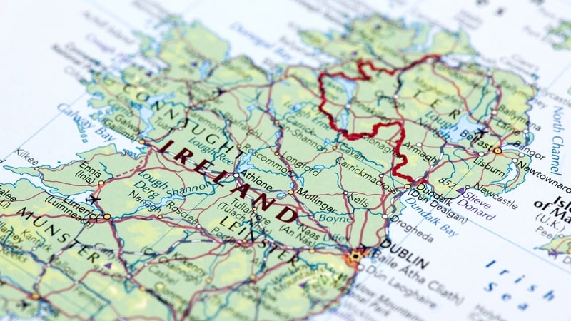
We present an extract from Ireland: Mapping the Island, the new book by Joseph Brady and Paul Ferguson.
Maps allow us to see how the world is organised spatially and show us relationships which cannot be understood from simply reading a text. This beautifully illustrated book highlights a vast selection of maps that range across the centuries and cover every part of the island, shedding light on the history and development of Ireland.
Maps are wonderful repositories. They not only record information but they show it in its spatial context. We see how natural features and human creations interact with each other on the landscape and we get a sense of the place; something which even the best writer will struggle to do in text. This book – Ireland – Mapping the Island – is a celebration of the maps of Ireland produced over the centuries. We aim to give our readers a sense of the huge variety of maps that have been drawn and of their value as documents. Quite a number of themes run through the book. We look at the importance of boundaries, what maps tell us about the development of towns and settlements, the ways in which maps have been used to create impressions of place, their role in the development of travel and how they facilitated the emergence of the 'tourist'. We also look at how others saw us and particularly at the maps produced since the 1930s by the military powers of a number of countries. One central focus is on how we learned about the shape and internal geography of Ireland. Before the development of airplanes and spacecraft, people had to take it on trust that we correctly knew the shape of the island of Ireland. That knowledge had been gradually refined for centuries and the state of knowledge was captured in the maps produced in each era.
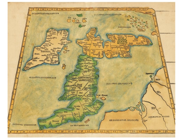
The earliest impressions came from seafarers. Travel by sea was dangerous, knowledge of the physical features encountered was crucial to navigation and was widely shared. The second-century geographer Claudius Ptolemy, who lived in Alexandria, knew about Ireland. The late medieval versions of his maps, many of which were produced in Germany and Italy, show Ireland as an ill-defined, blobby island with a handful of named rivers and tribes. Yet, it is remarkable that even this was known at that time.
From the fifteenth century onwards, Portolan charts added information. These sea charts were developed initially for Mediterranean trade but their scope expanded to include Britain and Ireland and the European coastline. The settlements a navigator would encounter along a coast were listed, together with significant physical features. Each successful voyage added new information, and the south and east coasts—the ones most engaged in trade—began to take on a recognisable form. Information on the interior was much more scant though the legacy of the Irish church in Continental Europe ensured that St Patrick's Purgatory (Lough Derg) was a constant feature.
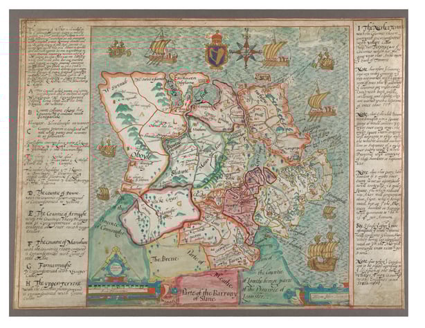
It was conquest that drove the mapping of this island’s interior. Good maps are essential to any army, both for conquering territory and, even more importantly, for managing it afterwards. This process accelerated during Tudor times. The conquest and resettlement of Munster and, later, of Ulster produced the most detailed maps of the interior yet created. Robert Lythe was employed to map the newly pacified lands in north-east Ulster, probably for Sir William Cecil, sometime after 1567 and was then commissioned to map the entire country. By 1570 he had a completed a survey of most of the country south of a line from Killary harbour to Strangford Lough. He must have wondered whether he had been wise to take on the project because he later wrote that it left him broken in health and half blind. Francis Jobson produced important maps of Munster and Ulster, which, among other things, mapped the Gaelic territories as well as the new territorial divisions that would replace them. These were vicious and dangerous times. Richard Bartlett, another cartographer, lost his head (literally) when he strayed too far into O’Donnell land in 1603. These were manuscript maps, single copies not intended for general circulation and we are fortunate that an excellent selection has survived in the library of Trinity College Dublin.
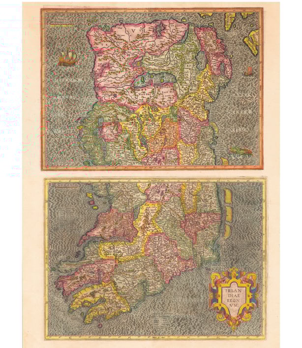
This period coincided with the Golden Age of Dutch cartography, when figures such as Geraldus Mercator and Abraham Ortelius dominated the production of atlases of the known world. Maps of Ireland and its provinces, based on the best sources, were included in these volumes, which appeared in many editions and languages. In 1611 John Speed, drawing on these resources and new information from the colonisation of Ulster, published his Theatre of the Empire of Great Britaine. It contained very detailed maps of the four provinces as well as the first map of Dublin city.
John Rocque during his short stay in Ireland in the 1750s produced a fine map of the country, a detailed survey of Armagh as well as the best map of Dublin to that point. There was never a shortage of decorative maps of Ireland but much work remained to be done in accurately depicting its geography. The interior needed greater detail, and the coast of Connaught was still relatively unknown. Interest from Britain and continental powers such as the French in producing accurate coastal charts for both trading and military purposes gradually improved matters. This ultimately led in the nineteenth century to the United Kingdom Hydrographic Office’s detailed survey of the seas around Ireland and of many parts of the world. Another wave of conquest produced maps of impressive precision of the interior, down to parish level. The Cromwellian conquest resulted in widespread confiscation of Catholic-owned land, and for this a detailed survey was required. William Petty’s Down Survey (1656–1658), supplemented by the earlier Stafford Survey of Connaught, became the gold standard for determining property ownership and formed the basis of property taxation until the monumental work of the Ordnance Survey after 1830 facilitated the General Valuation (better known as Griffith’s) in the 1840s.
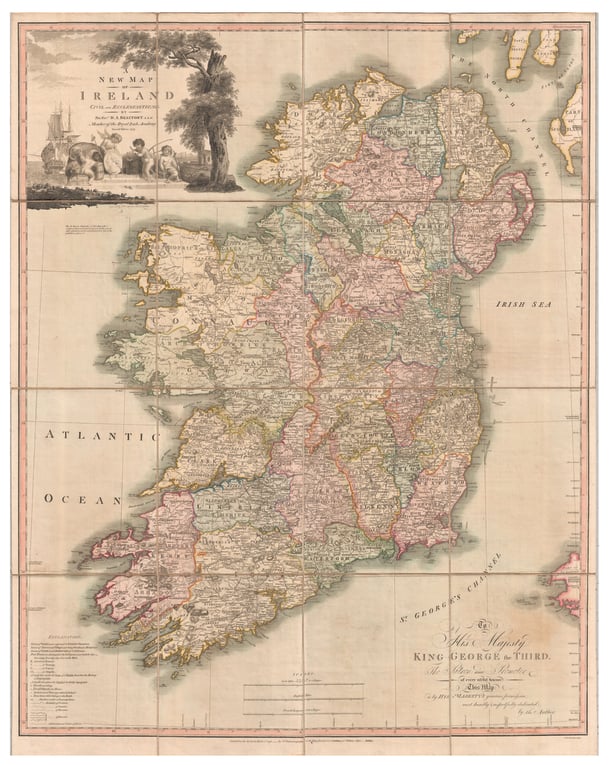
Even so, Ireland’s shape was still imperfectly known. Features and settlements were not always correctly aligned, distances on maps did not match the reality on the ground, and compass directions were often unreliable. A breakthrough came in 1792, when Daniel Beaufort, a Church of Ireland clergyman and scientist, produced the most geometrically accurate map of Ireland to date. Though he had set out only to map ecclesiastical districts, Beaufort was so frustrated by the errors in existing maps that he undertook a comprehensive revision. His work provided the best picture of Ireland’s shape and geography until the Ordnance Survey carried out its scientific survey of the entire island and fixed it accurately. Published at a scale of six inches to the mile, the first edition of this survey was completed in 1846 and for the first time people in every part of the country could have a detailed bird’s eye view of their locality.
Ireland: Mapping the Island is published by Birlinn